X
Comments to #3
All comments (X)
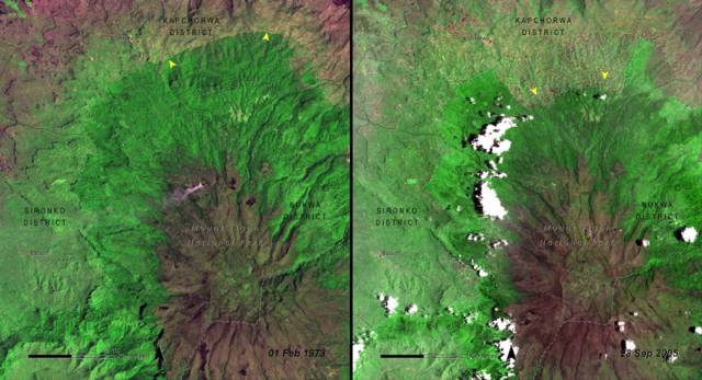
Starting in the 1970s, NASA began using satellite images to document deforestation in several national parks around the world. Here's Mount Elgon National Park in Uganda in 1973 (left), compared with the park in 2005 (right).