Shrinking Aral Sea, Central Asia
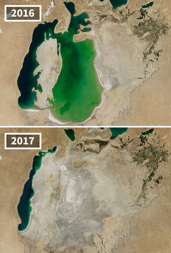
"The Aral Sea was the fourth largest lake in the world until the 1960s, when the Soviet Union diverted water from the rivers that fed the lake so cotton and other crops could be grown in the arid plains of Kazakhstan, Uzbekistan and Turkmenistan. The black outline shows the approximate coastline of the lake in 1960. By the time of the 2000 image, the Northern Aral Sea had separated from the Southern Aral Sea, which itself had split into eastern and western lobes. A dam built in 2005 helped the northern sea recover much of its water level at the expense of the southern sea. Dry conditions in 2014 caused the southern sea’s eastern lobe to dry up completely for the first time in modern times. The loss of the moderating influence of such a large body of water has made the region’s winters colder and summers hotter and drier."


yep....noticed that too.

Um, no I didn't notice that at all. One effort shows data from 2004, mainly due to 2004 being such a major year for the Muir Glacier. The rest are pretty recent. 20% are from 2020. 75% from the last 5 years.
Unless you meant that any remote sensing data is from the past, even if taken seconds ago.
Satellite data usually takes a little while to be made public due to processing requirements (e.g. ICESat-2 was launched in 2018, but some higher level products haven't been produced yet.) Then researchers need time to figure out what the data is actually showing.

Also, regarding the images being a few years old, that’s obviously for security reasons. Satellite images made available to the public are never current for obvious reasons.


yep....noticed that too.
Um, no I didn't notice that at all. One effort shows data from 2004, mainly due to 2004 being such a major year for the Muir Glacier. The rest are pretty recent. 20% are from 2020. 75% from the last 5 years.
Unless you meant that any remote sensing data is from the past, even if taken seconds ago.
Satellite data usually takes a little while to be made public due to processing requirements (e.g. ICESat-2 was launched in 2018, but some higher level products haven't been produced yet.) Then researchers need time to figure out what the data is actually showing.
Also, regarding the images being a few years old, that’s obviously for security reasons. Satellite images made available to the public are never current for obvious reasons.