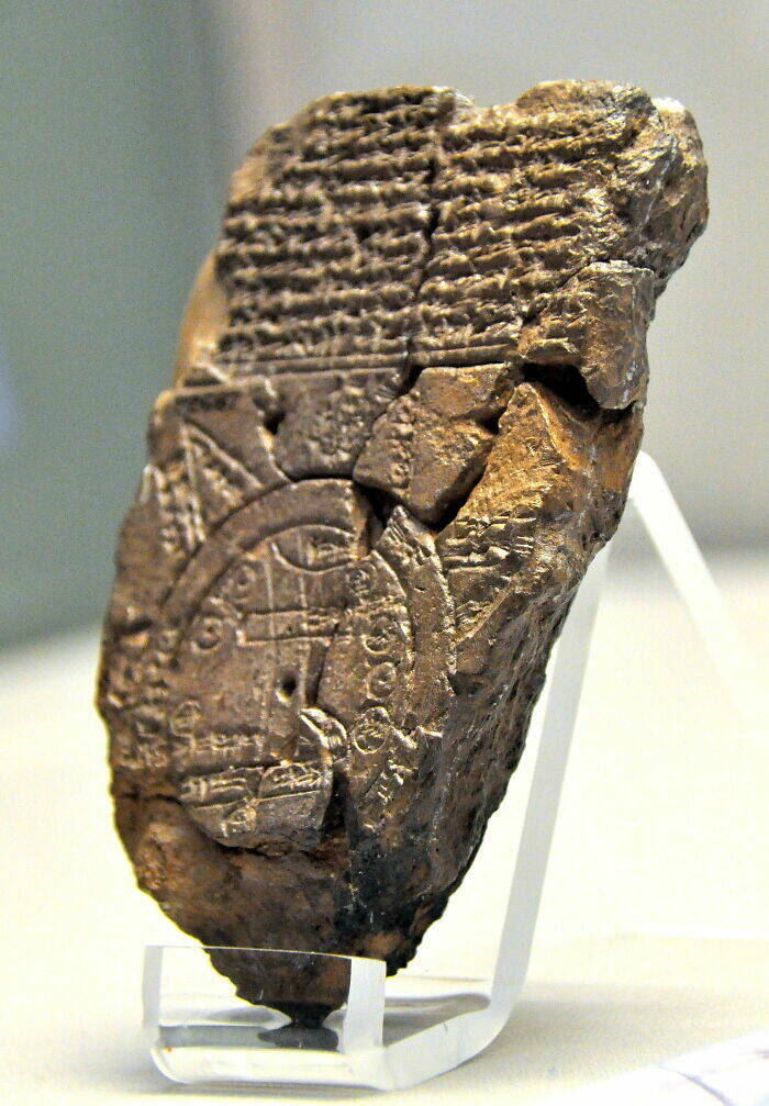
Babylonian Map Of The World (900 BC – 700 BC)

This famous ancient artifact is an early depiction of the world, as known by the Babylonians around 900 BC. It is typical of old-world maps in that it centers on local features, such as the Euphrates, and then expands outwards. The Babylonian Map covers neighboring cities with accompanying labels, followed by an ocean and several landmasses beyond it.
3.

Griselda 3 year s ago
Samson,
it's interesting because nobody was able to decipher it. It was sold to Rudolf II at some point so chances are it was just faked to make money, however when they analyzed the texts there was no statistical evidence that it was just made up. It checked out as a language (from a statstical point of view) so it _may_ well be a code.
it's interesting because nobody was able to decipher it. It was sold to Rudolf II at some point so chances are it was just faked to make money, however when they analyzed the texts there was no statistical evidence that it was just made up. It checked out as a language (from a statstical point of view) so it _may_ well be a code.
4.

Dickon 3 year s ago
I think you started overusing the term "most famous artifact" when you got to #21.
#24 Mm-hm. "Detailed."
#28 Is he resting his massive chin on his... ? Impressive, indeed.
#30 No forms of entertainment? There were toys for kids, there was music, dancing, many forms of art, plays, drinking, orgies... more drinking and more orgies... that's... well, that's about it, I guess.
#33 They seem unsure. The sign reads: "Burial site of Richard III?"
9.

Polly 3 year s ago
#4 due to the fact that it had the same script written in 3 languages and one of it was ancient Greek that people can still read even today. I understand that Russia has allied with turkey against Ukraine and you russians hate anything that reminds you of Democracy, but don't be so scared to mention historical facts. After all you live in America, the land of freedom.


you haven't seen Galaxy Quest, have you?
it's interesting because nobody was able to decipher it. It was sold to Rudolf II at some point so chances are it was just faked to make money, however when they analyzed the texts there was no statistical evidence that it was just made up. It checked out as a language (from a statstical point of view) so it _may_ well be a code.
#24 Mm-hm. "Detailed."
#28 Is he resting his massive chin on his... ? Impressive, indeed.
#30 No forms of entertainment? There were toys for kids, there was music, dancing, many forms of art, plays, drinking, orgies... more drinking and more orgies... that's... well, that's about it, I guess.
#33 They seem unsure. The sign reads: "Burial site of Richard III?"
So how old was Napoleon in the early 1700s?
#10 Galileo was wrong. The 97% scientific consensus was...