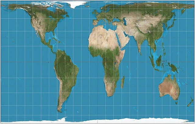
The Gall-Peters Projection world map

While originally created by James Gall in 1885, the Gall-Peters Projection came into public consciousness in 1967 when Arno Peters championed it as a more accurate representation of the size of countries. It was considered controversial for calling into question the way the "third-world" is represented.
1.
crispy 13 year s ago
Waaaa! Cry me a river. Social equality my ass. If they want social equality they should have made their civilizations into something other than a cesspool. 90% of Africa and 100% of South America were nothing until Europeans came along.
2.
Elbereth 13 year s ago
Social equality I reckon is beyond any governments ability. However it does make a statement, that we don't know where anything really is, and that changes our perception of our planet!
What maps do N.A.S.A. use? What do the photographs from space tell us about the placement of our continents?
What maps do N.A.S.A. use? What do the photographs from space tell us about the placement of our continents?
3.

Johny 13 year s ago
#18 - Have you ever wanted to be in the center of attention so bad you cut Asia in half???
Well, that escalated quickly.
Well, that escalated quickly.


What maps do N.A.S.A. use? What do the photographs from space tell us about the placement of our continents?
Well, that escalated quickly.