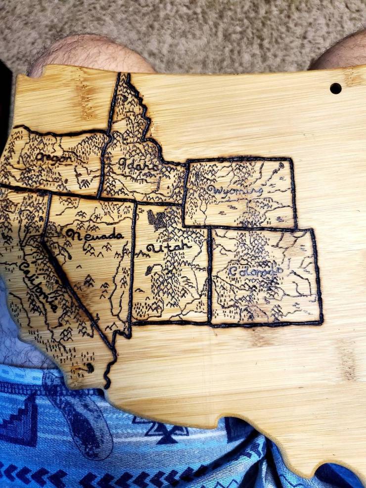
"This Is My Wedding Gift To My Wife. We Get Married Next Sunday. I Used A Woodburning Kit To Burn A Map Of All The States We Have Visited As A Couple. We Both Love To Travel And Backpack Do I Want To To Keep Adding To It As We Get Older"
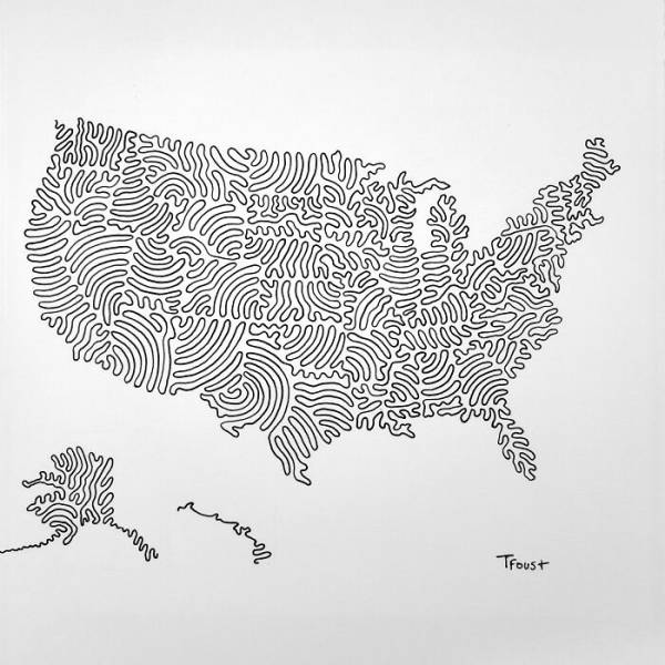
"USA In Drawn In 3 Lines. Boundaries Marked With Gaps (The Best I Could)"
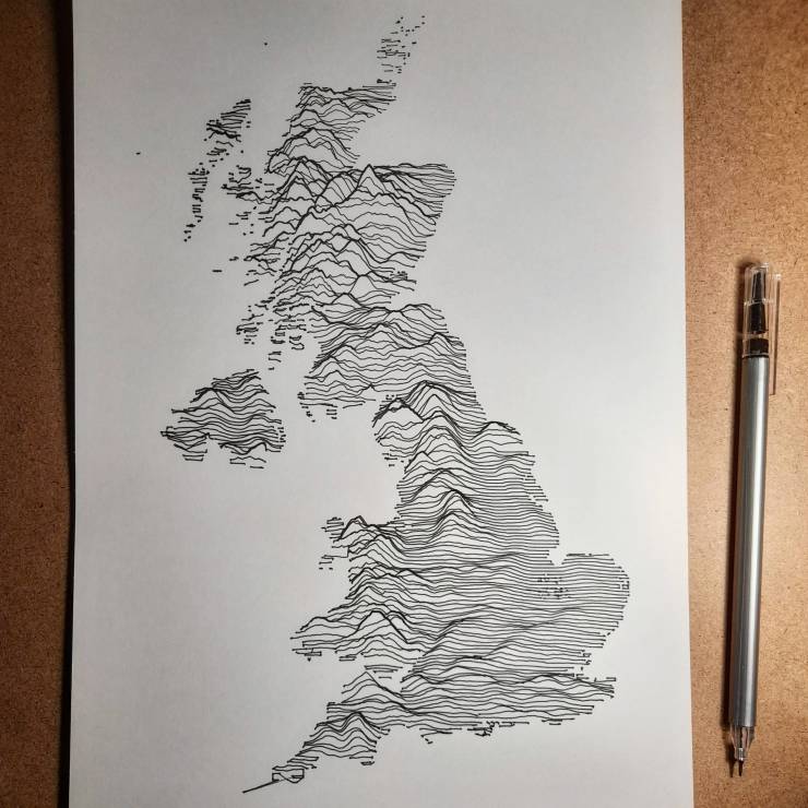
United Kingdom
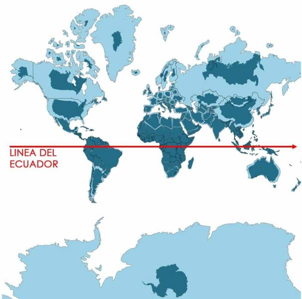
"Light Blue Is A Map As We Know It And Dark Blue Is The Actual Size Of Each Country"
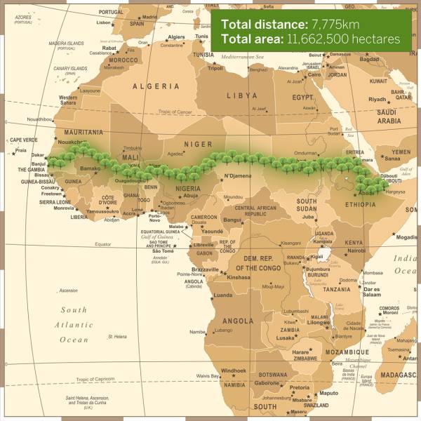
"To Combat The Threat Of Desertification Of The Sahel (The Region Immediately To The South Of The Sahara), The African Union Is Leading An Initiative To Plant The Great Green Wall, A 7,775 Km (4,830 Mi) Belt Of Trees Crossing The Entire Breadth Of North Africa"
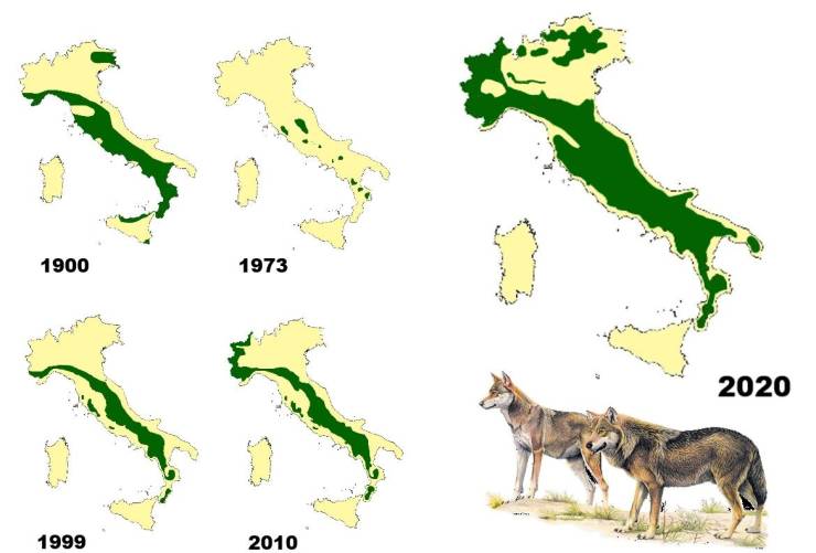
"Wolf Distribution In Italy From 1900 To 2020"
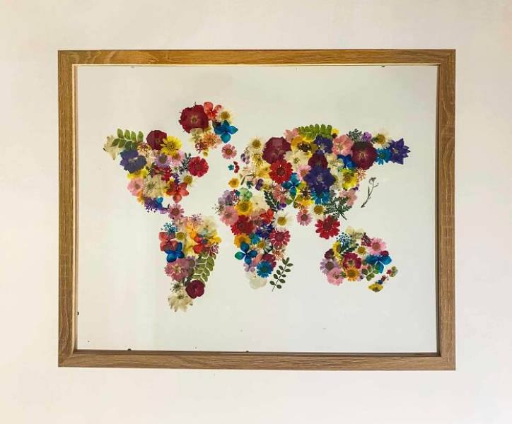
"Map I Made Out Of Pressed Flowers!"
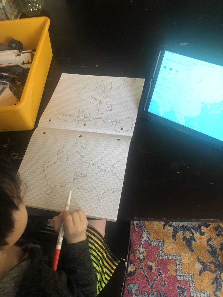
"Just Walked In The Room And Found My 6 Year Old Drawing Countries By Hand"
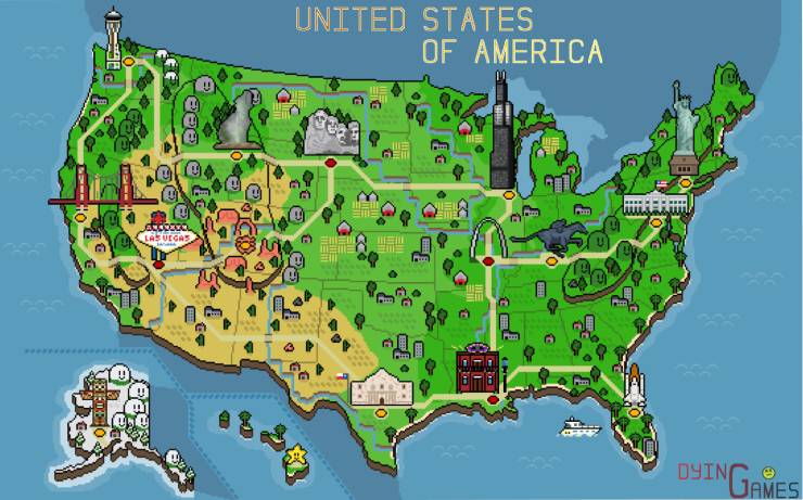
"I Made A Retro Pixel Map Of The USA! Tried To Include Some Of The Iconic Monuments/Locations That Resonated With Me"
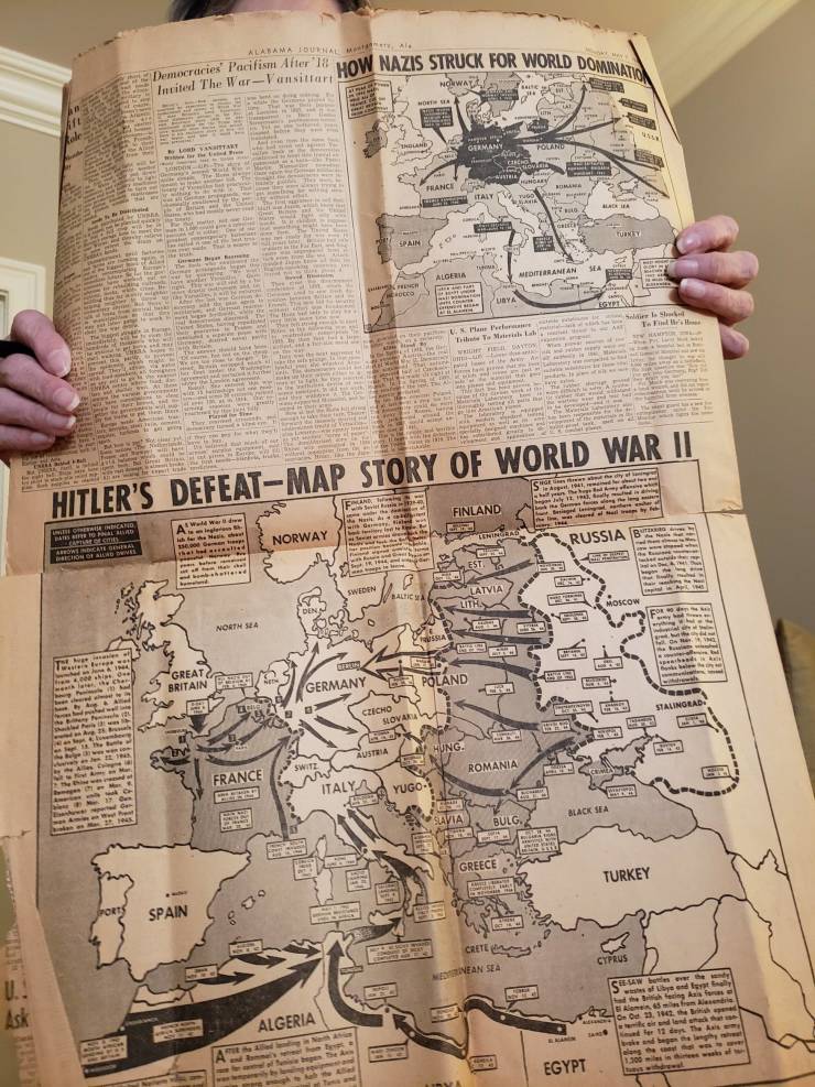
"Newspaper My Great Grandfather Saved From The End Of Wwii (I Have More Photos But This Subreddit Doesn't Allow A Gallery)"
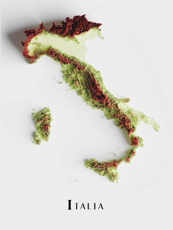
"The Topography Of Italy"
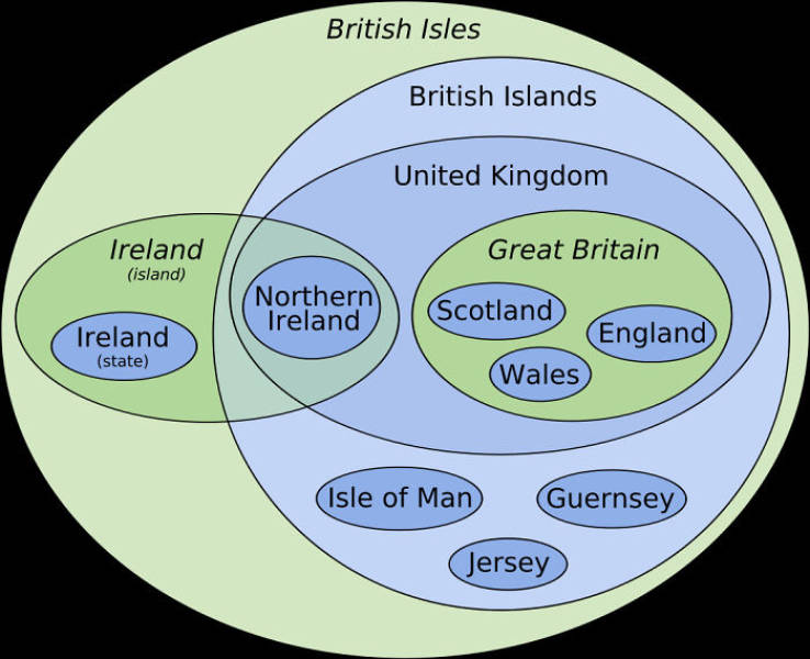
"Euler Diagram-Map Of The British Isles"
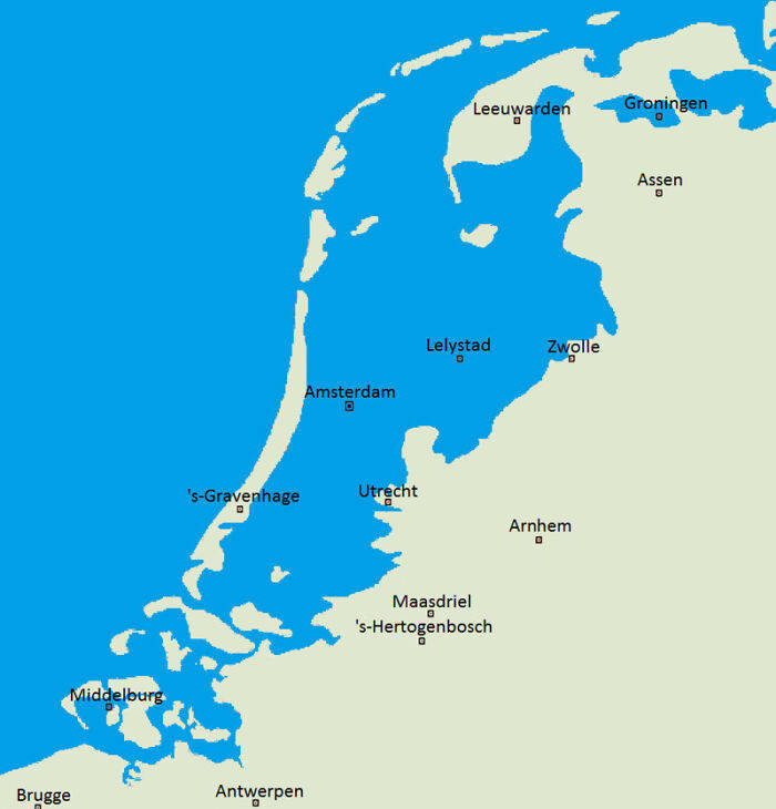
"What The Netherlamds Would Naturally Look Like If They Hadn't Built Any Dikes To Prevent Flooding"
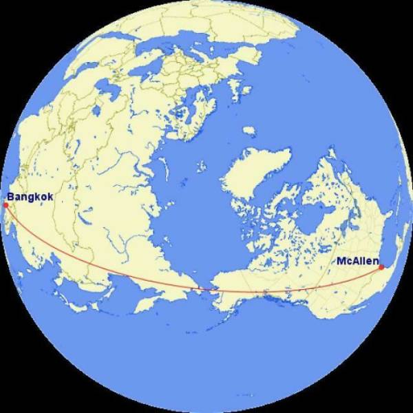
"If You Flew In A Straight Line From Mcallen, Texas To Bangkok, Thailand, You Would Only Spend About 50 Miles Over Water"
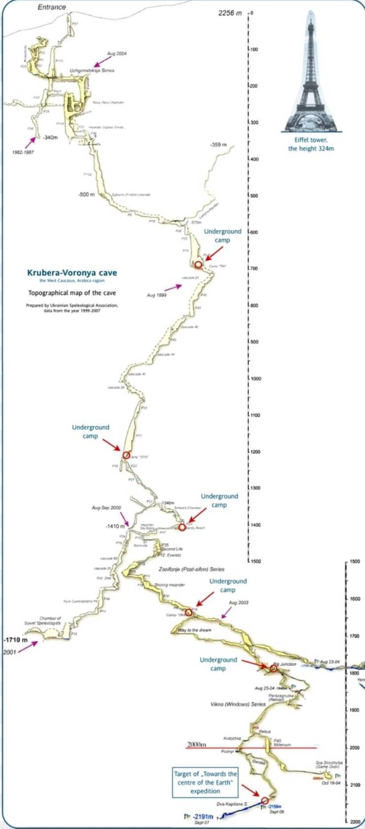
"Map Of The 2191 Meter Deep Krubera Cave. The Deepest Known Cave System In The World"
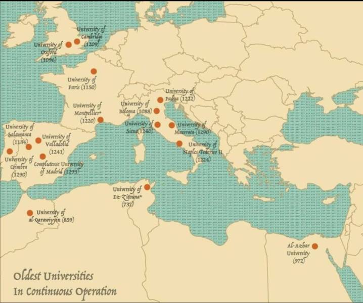
"The Oldest Universities In Continuous Operation"
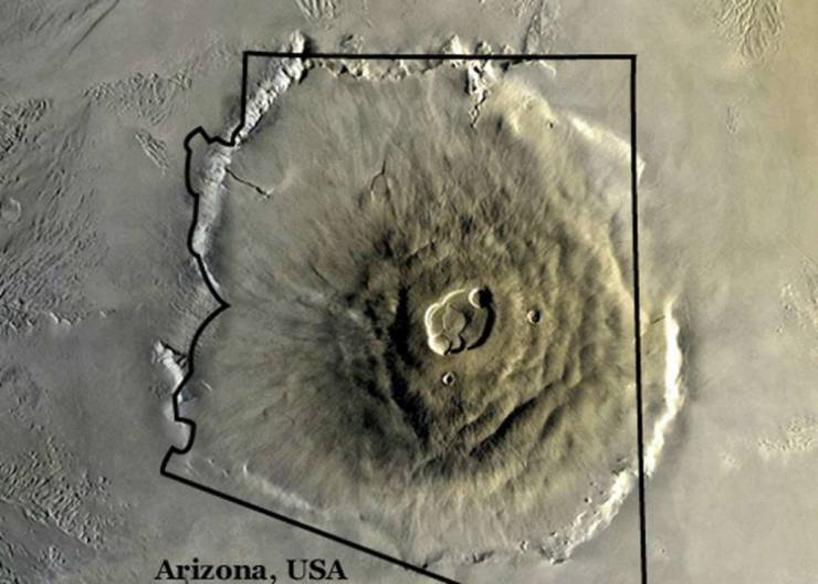
"Olympus Mons On Mars, The Largest Volcano In Our Solar System, Compared To Arizona"
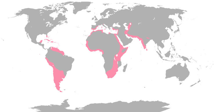
"Where Flamingos Are Found Naturally In The World"
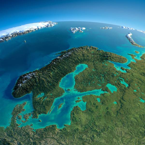
"Relief Map Of Baltic And Scandinavia"
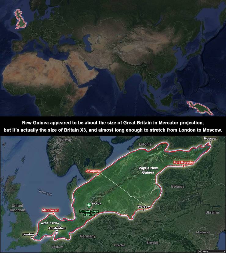
"The True Size Of New Guinea"
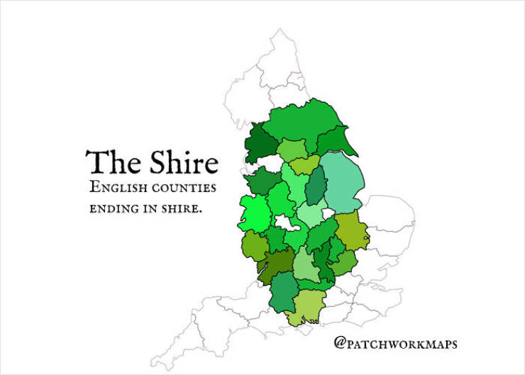
"The Shire - English Counties Ending In 'Shire'"
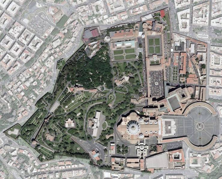
"Satellite Map Of Vatican City"
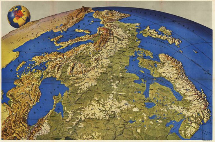
"Europe Seen From Russia (Made In The 1950s)"

