This World Map Is Made Of Only Air Currents. If You Look Closely, You'll See Country Outlines
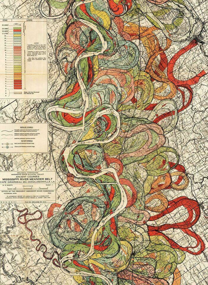
History Of The Mississippi River, As Drawn In 1944
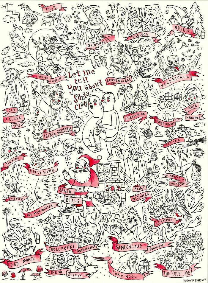
I Made This Poster After Researching The Origins Of Santa Claus
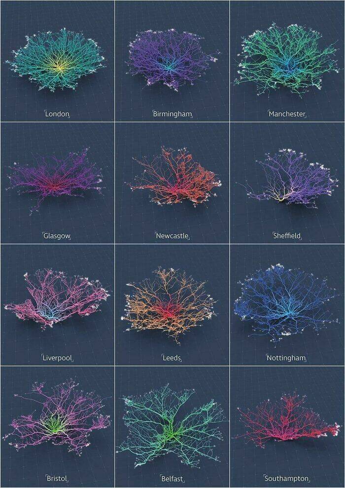
Coral-Like Cities To Show Road Networks
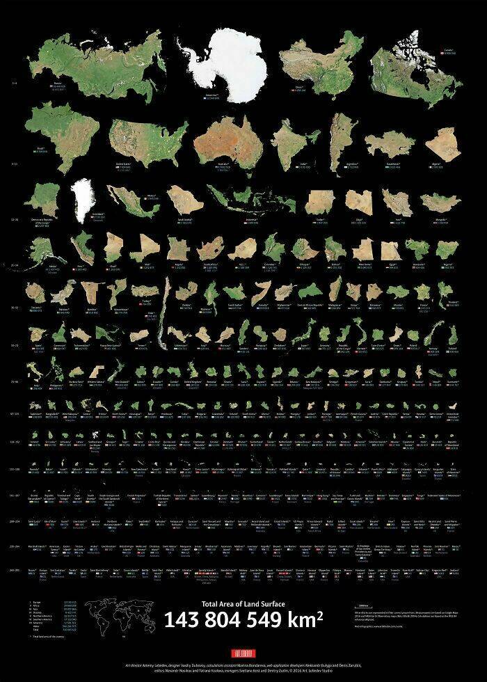
Real Proportions Of All Land Masses Revealing Actual Areas Of Countries, Territories And Major Islands Without Any Distortions
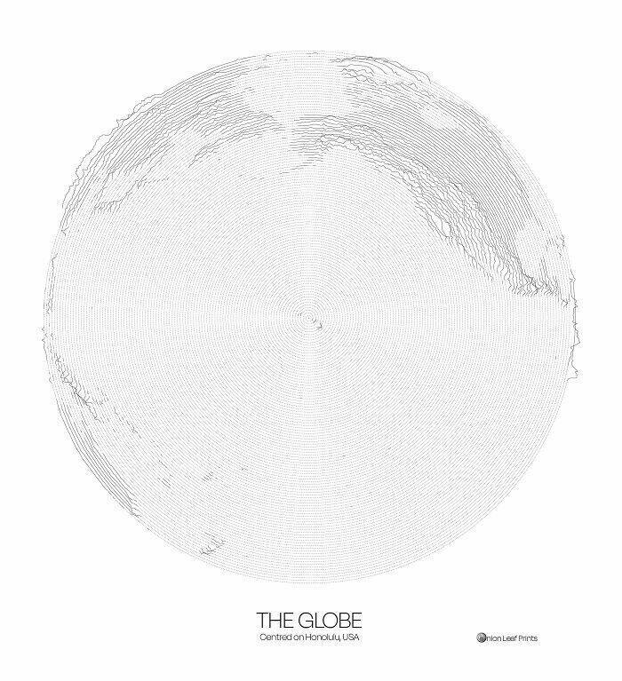
The Globe Centred On Honolulu - Topographic Map From A Single Spiral Line
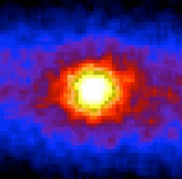
This "Photo" Of The Sun Uses Neutrinos Instead Of Light, And Is Taken At Night By Looking Through The Earth
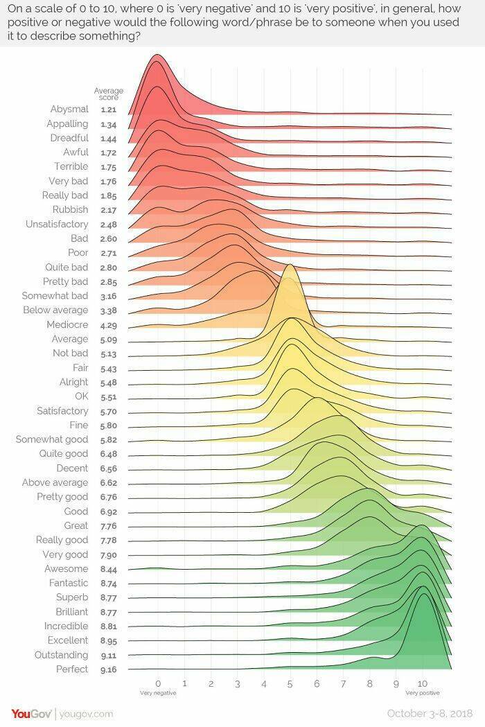
The Sentiment Scale: How Positive Or Negative A Word Sounds
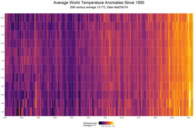
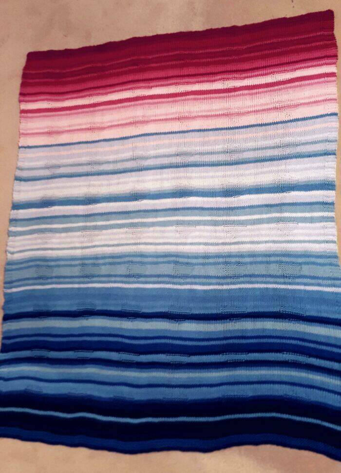
139 Years Of Global Temperatures Knit Into A Baby Blanket
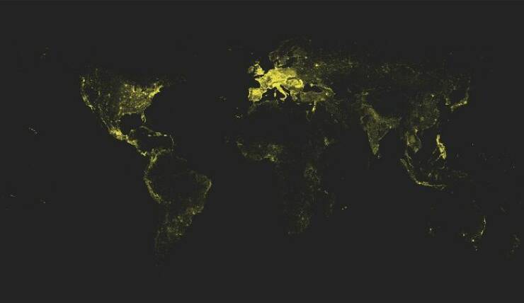
Lat And Long Data Of Every Town In The World With More Than 1000 People
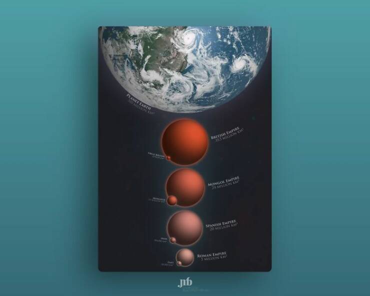
(Some Of) The Largest Empires Of History, Visualised As Planets Orbiting Earth
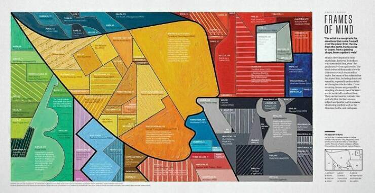
Most Common Themes Of 8000 Picasso Paintings, Visualised In The Style Of Picasso

