The people who went and go to space are no doubt one of the luckiest people. Because they get the chance to see our home from space which is a priceless opportunity. But thanks to the space scientists and astronauts we can also see the glimpses of our earth from space through photographs.
Thanks to modern day space equipment we can capture any natural disaster or natural wonder, man made structures to landmarks. In just seconds satellites can capture every important event in earth’s history and archive it.
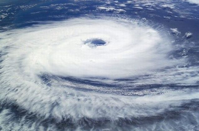
You can find many amazing photos of earth from space. But today we are presenting the best compilation of 26 amazing and outstanding photos of earth from space. This compilation contains photos of disasters, natural wonders, cities and landscapes.The crew of the International Space Station took this photograph of Hurricane Catarina, which struck the coast of Brazil in 2004. Very few hurricanes have ever developed this far south, just a few tropical storms.
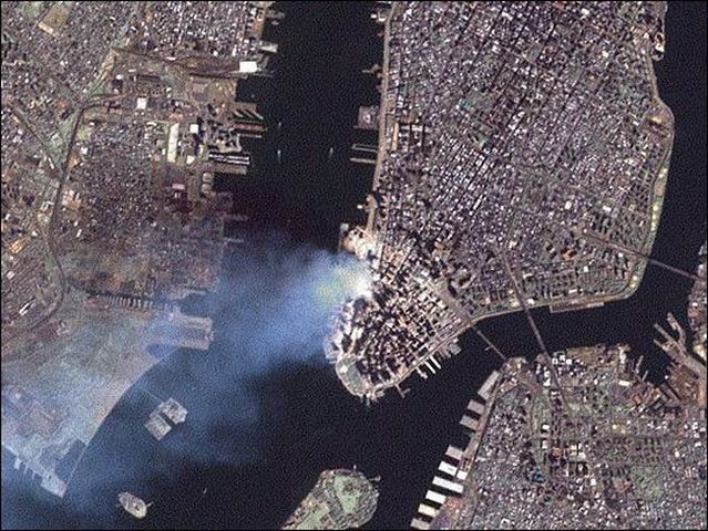
This is a pic of New York City after the World Trade Center attack on September 11, 2001. The image was captured by NASA’s Landsat 7 satellite on September 12th at 11:30am. At this point, the twin towers had fallen, and smoke was still pouring out of the region.
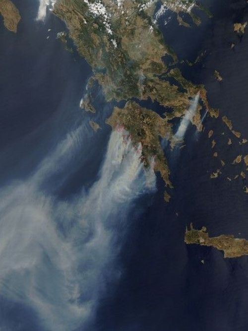
NASA’s Aqua satellite captured this image of fires ravaging Greece in the summer of 2007. More than 60 people were killed, and hundreds of homes were burned. Thousands had to evacuate the affected region.
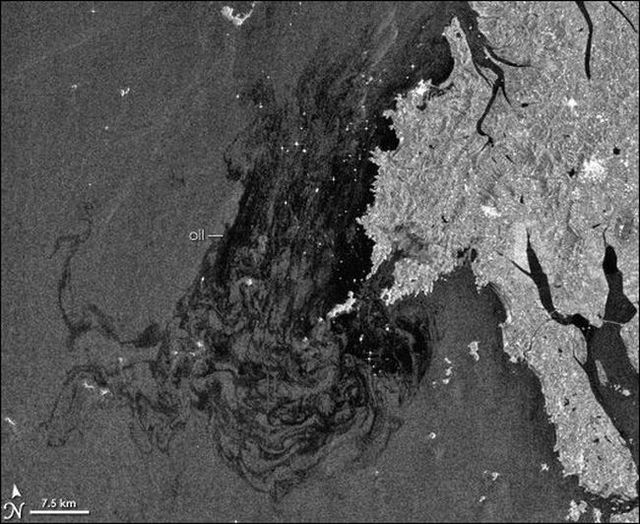
When the 146,000-ton tanker, Hebei Spirit, ran aground off the coast of South Korea, it leaked a tremendous amount of oil into the surrounding ocean. This is an image captured by ESA’s Envisat Earth Observation satellite showing the size of the oil spill.
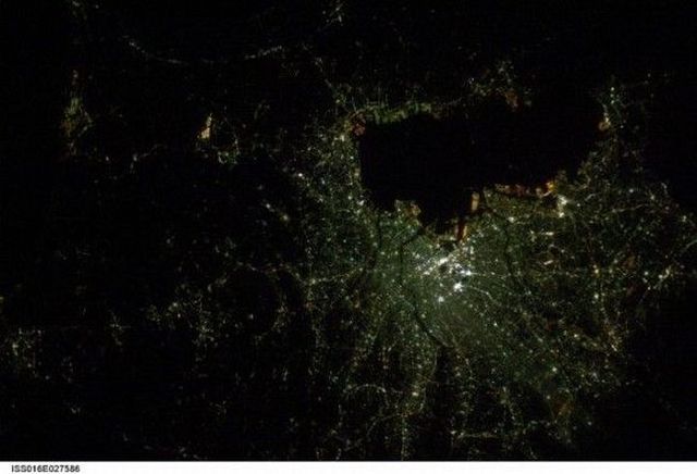
This is a photograph of Tokyo, Japan - the biggest city in the world - imaged by International Space Station astronaut Dan Tani on February 5, 2008. The brightest part of the city is the center, with ribbons of light stretching out of the city center following roads and public transit routes.
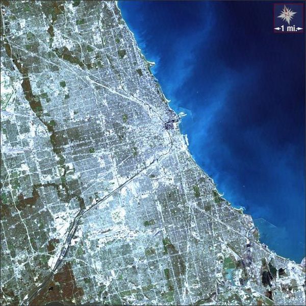
Here’s a photograph of Chicago, one of the largest cities in the United States, located on the shores of Lake Michigan. This space pic was taken by NASA’s Landsat 7 satellite. This photograph was taken on October 19, 2000.
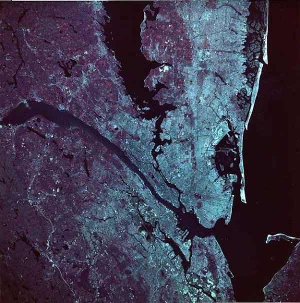
This next image from space is of New York City, New York. Brooklyn is off to the right-hand side of the image, and Manhattan Island is almost perfectly in the center of the image. The photograph was taken during the space shuttle mission STS-039.
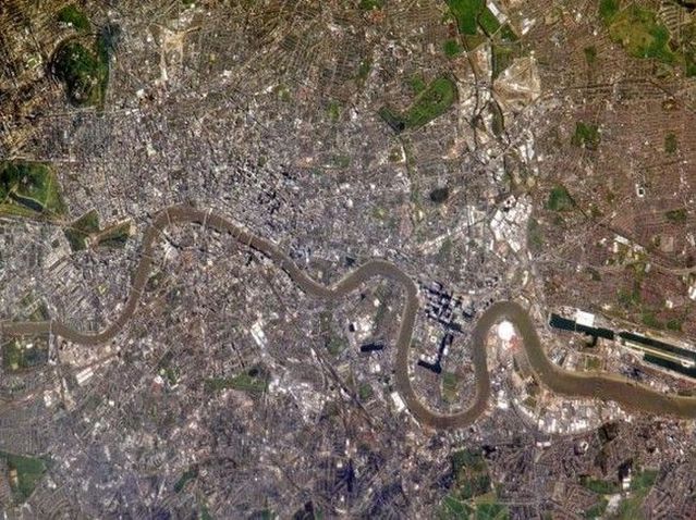
Here’s a high-resolution image of London taken from the International Space Station in 2005. You can see many London landmarks, including Regent’s Park, Hyde Park and St. James’s Park east of Buckingham Palace.
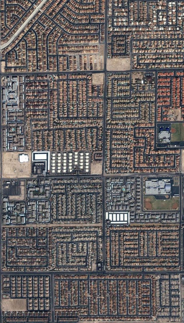
And finally now, houses and streets in bustling Las Vegas, Nevada are seen in this image from the commercial IKONOS satellite taken in September of 2004.
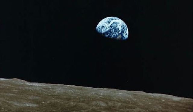
This is one of the most famous photographs ever taken. It was captured by NASA astronaut Bill Anders as Apollo 8 was orbiting the Moon. This was the first time that humans had ever gone into orbit around another object in the Solar System. Seeing the entire Earth as a tiny ball hanging in space was nothing short of life changing.
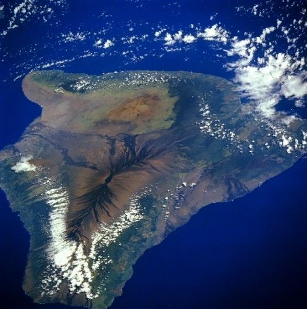
This photo is of the Big Island of Hawaii. This photograph shows off the entire island, including the three volcanoes that helped to create it: Mauna Loa, Mauna Kea, and Kilauea.
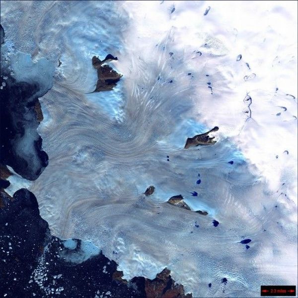
It’s a view along Greenland’s western coast. You can see a small field of glaciers that surrounds Baffin Bay. The bright blue spots are lakes that appear in the warmer southern months across the Greenland ice sheet. This photograph was captured by NASA’s Landsat 7 spacecraft.
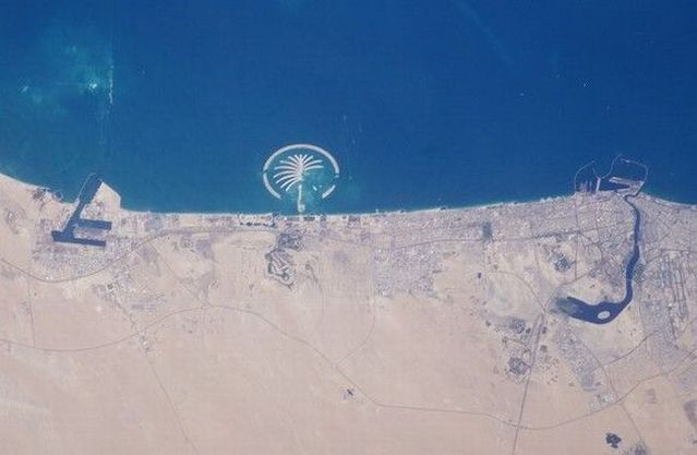
This is a satellite picture of the Palm Island Jumeirah structure off the coast of Dubai.
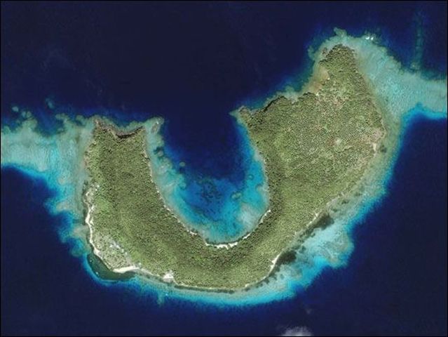
This is Matangi Island, part of the Fiji group of islands. It’s surrounded by warm ocean water and vibrant coral reefs. This photograph was captured by the Ikonos spacecraft, which can see 10 meters through water, to reveal the coral reef.
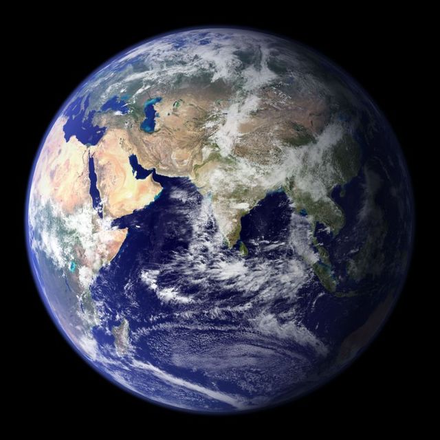
This spectacular “blue marble” image is the most detailed true-color image of the entire Earth to date. Using a collection of satellite-based observations, scientists and visualizers stitched together months of observations of the land surface, oceans, sea ice, and clouds into a seamless, true-color mosaic of every square kilometer (.386 square mile) of our planet.
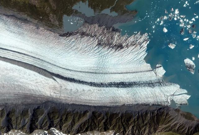
The Bear Glacier on the Kenai Peninsula along the Gulf of Alaska seen by the IKONOS satellite took this on August 8, 2005. This image shows the ablation zone where the glacier is primarily losing ice. Upslope from the lake, the foot of the glacier is riddled with crevasses - cracks in the ice caused by the glacier’s movement over a rough surface.
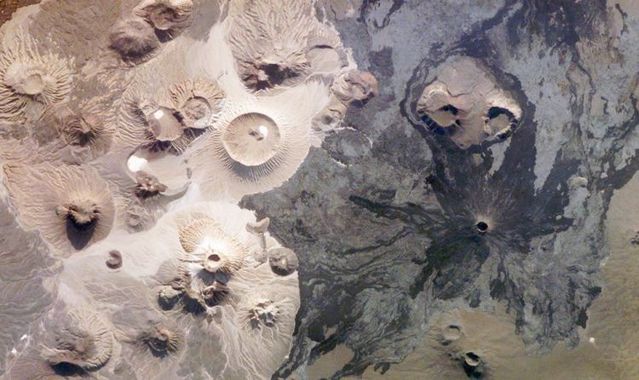
Harrat Khaybar in Saudi Arabia contains a wide range of volcanic rock types and spectacular landforms, several of which are represented in this photograph taken by an astronaut abourd the International Space Station on March 31, 2008. Jabal (”mountain” in Arabic) al Qidr is built from several generations of dark, fluid basalt lava flows. Jabal Abyad, in the center of the image, was formed from a more viscous, silica-rich lava classified as a rhyolite.
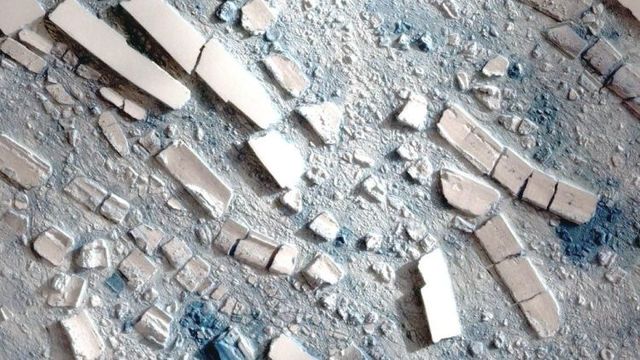
This highly detailed image from the Taiwanese Formosat-2 satellite shows the different sizes, shapes, and textures of ice fragments from an ice shelf on the Antarctic Peninsula on March 8, 2008. Several large icebergs float amid a mosaic of smaller pieces of ice. The level of detail in the image is so great that it can seem as though you are standing over a scale model made out of paper-made and foam blocks. The detail can make the bergs seem deceptively small. In reality, some of the large bergs are several hundred meters (yards) long.
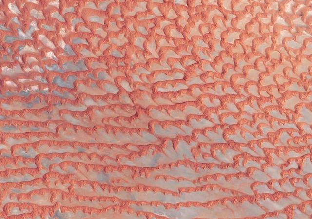
The Arabian Peninsula’s Empty Quarter, known as Rub’ al Khali, is the world’s largest sand sea, holding about half as much sand as the Sahara Desert. The Empty Quarter covers 583,000 square kilometers (225,000 square miles), and stretches over parts of Saudi Arabia, Yemen, Oman, and the United Arab Emirates. The Enhanced Thematic Mapper on NASA’s Landsat 7 satellite captured this image of the Empty Quarter on August 26, 2001.
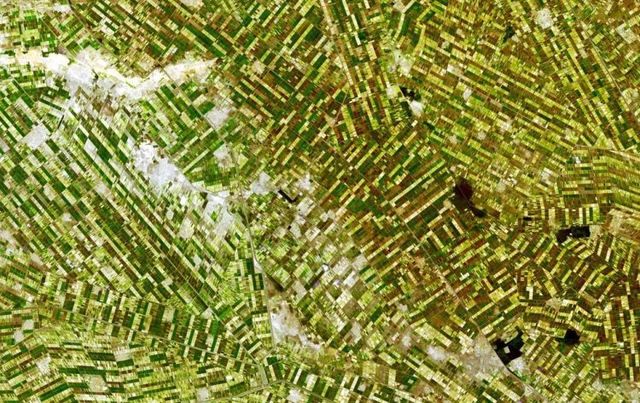
South of Khartoum, Sudan, where the White and Blue Nile Rivers join, a dizzying arrangement of irrigated fields stretches out across the state of El Gezira. The several bare-looking patches are small villages. This image was captured by the Advanced Spaceborne Thermal Emission and Reflection Radiometer (ASTER) on NASA’s Terra satellite on December 25, 2006.
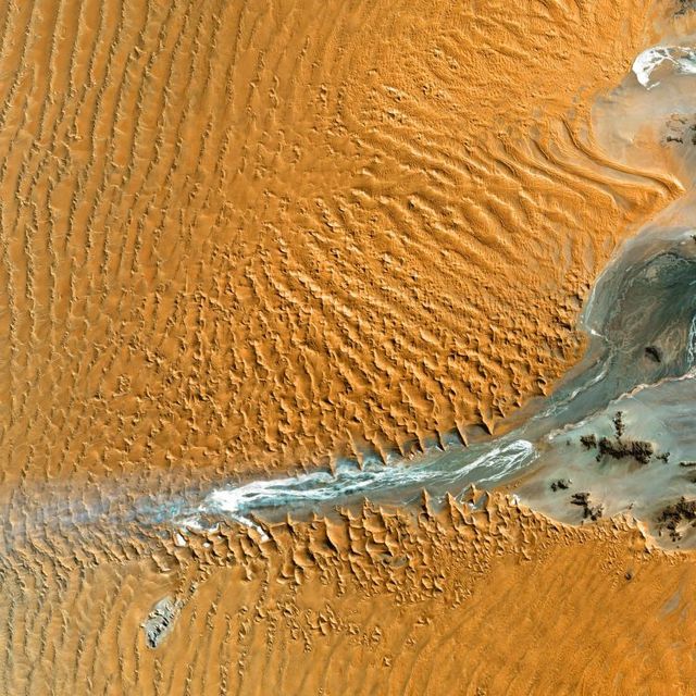
Namib-Naukluft National Park is an ecological preserve in Namibia’s vast Namib Desert. Coastal winds create the tallest sand dunes in the world here, with some dunes reaching 980 feet (300 meters) in height.
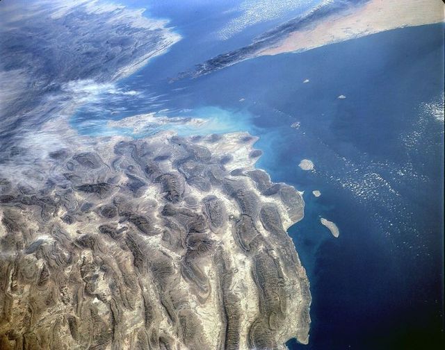
One of the most spectacular examples of anticlinal fold structures lie on the north shore of the Strait of Homuz in the Persian Gulf. Located near the important city of Bandar Abbas, these folds form the foothills of the Zagros Mountains, which run north-northwesterly through Iran. The folds were formed when the Arabian shield collided with the western Asian continental mass about 4 to 10 million years ago. Subduction still continues slightly further east, beneath Baluchistan, but is inactive in the Gulf itself.
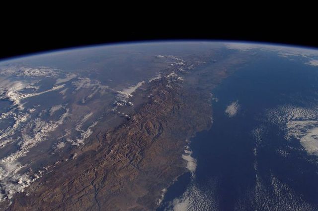
The Andes mountains form one of the longest continuous mountain ranges on Earth, extending from the shores of the Caribbean as far south as the Magellan Straits. Perhaps the most surprising aspect of this range is how narrow it is over much of its length - the high part of the range is typically less than 150 kilometers (93 miles) broad. Illustrated is the section of the Andes near Coquimbo, Chile, where the highest peaks are 6,300 meters (20,670 feet).
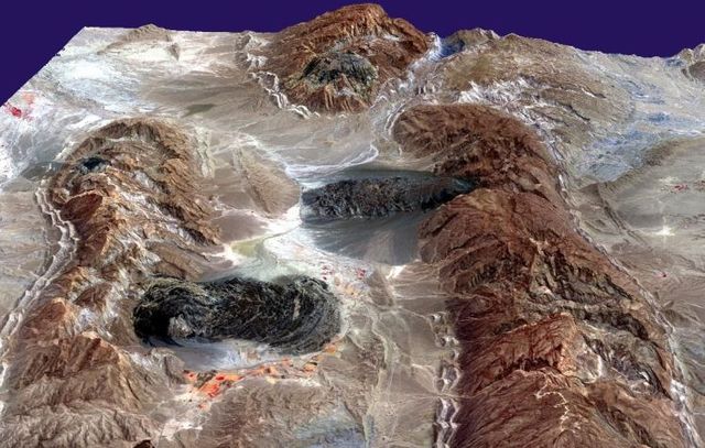
The diapirs, or salt plugs, in this image are a few of over 200 similar features scattered about this part of the Zagros Mountains in southern Iran. This region of folded rocks is the result of the collision between the Asian landmass and the Arabian platform. The deeper underlying deposits of salt have been reformed into ascending fluid-like, plastic plumes of salt. In some places these plumes have pushed through the overlying rock units, like toothpaste extruding from a tube, and are now visible as darkish irregular patches.
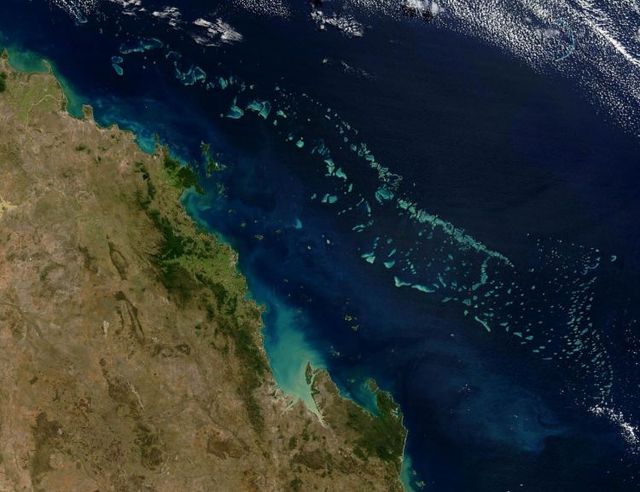
Colonies of coral appear vibrant blue green in this Moderate Resolution Imaging Spectroradiometer (MODIS) image of Australia’s Great Barrier Reef. Stretching over 2000 kilometers along the northeast coast of Australia, the Great Barrier Reef is the largest coral system that has ever existed. It is made up of about 2,900 reefs with at least 350 different species of coral, though only about six percent are coral reefs.
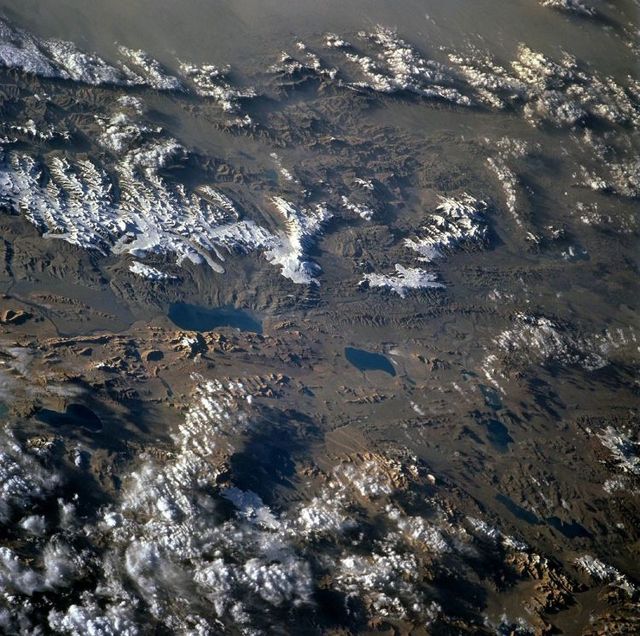
The Tibet plateau is the largest and highest elevated region in the world. The plateau is 1,200 kilometers (746 miles) from east to west and 900 kilometers (560 miles) north to south, with a mean elevation of about 4900 meters (16,000 feet). The lowlands and valleys range in elevation from 3700 meters to 4600 meters (12,000 feet to 15,000 feet). Because the plateau rises above so much of the atmosphere, photographs are typically brilliantly crisp and clear.
[via
newzonfire.com
]



than you see something like this,amazing