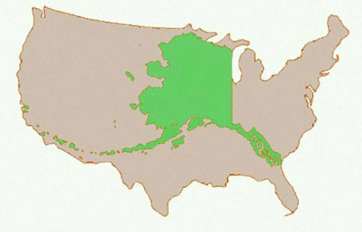
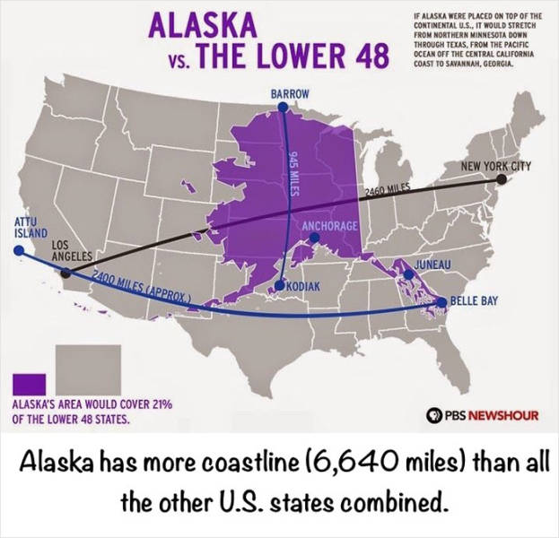
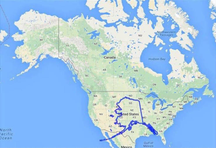
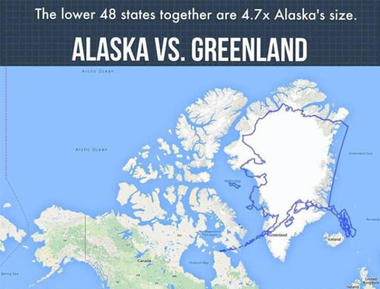
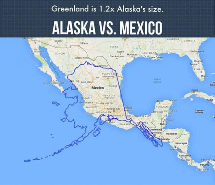
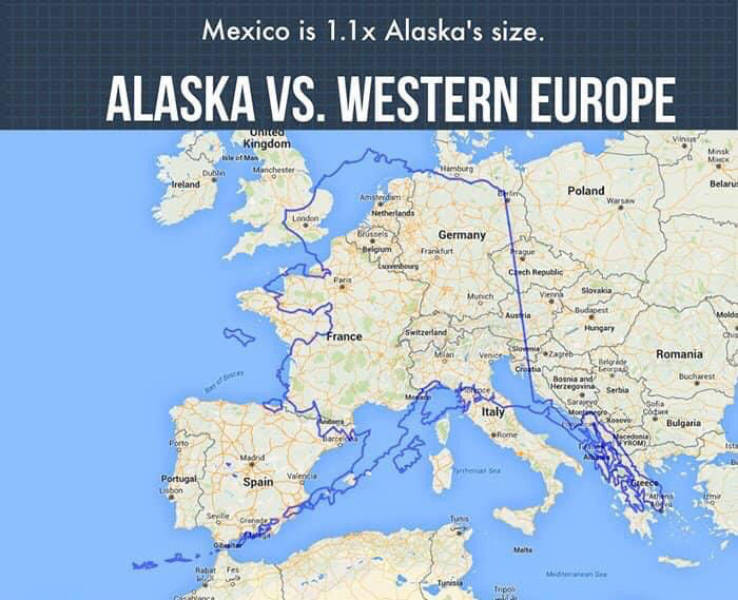
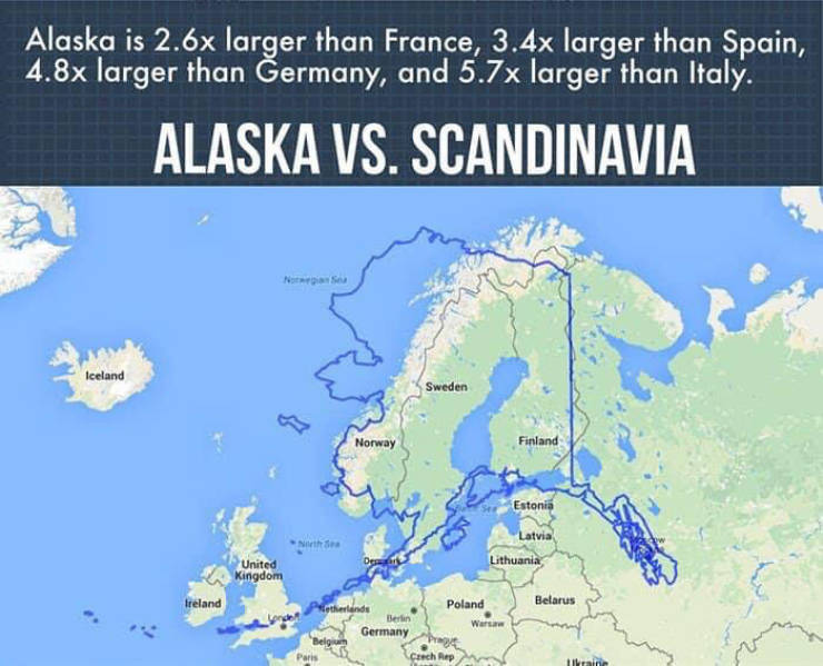
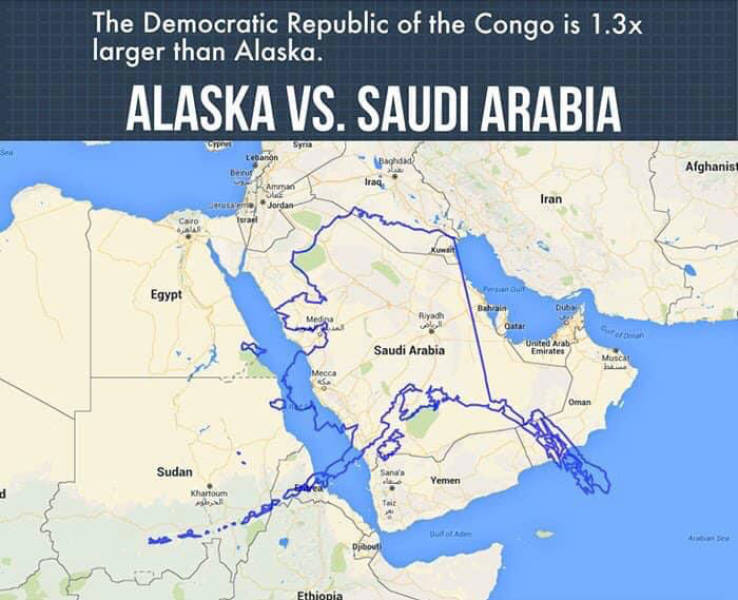
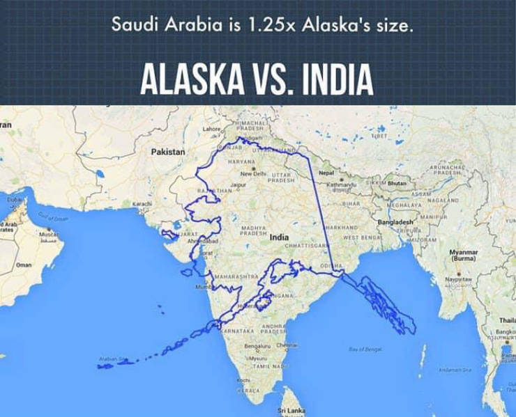
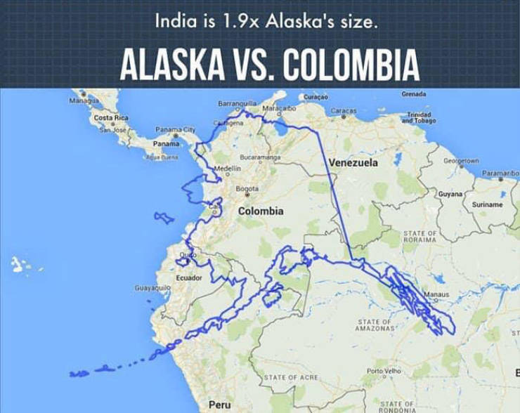
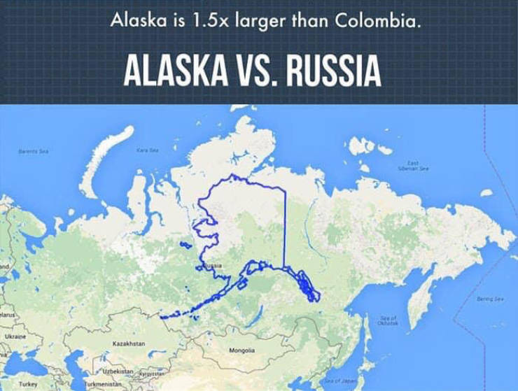
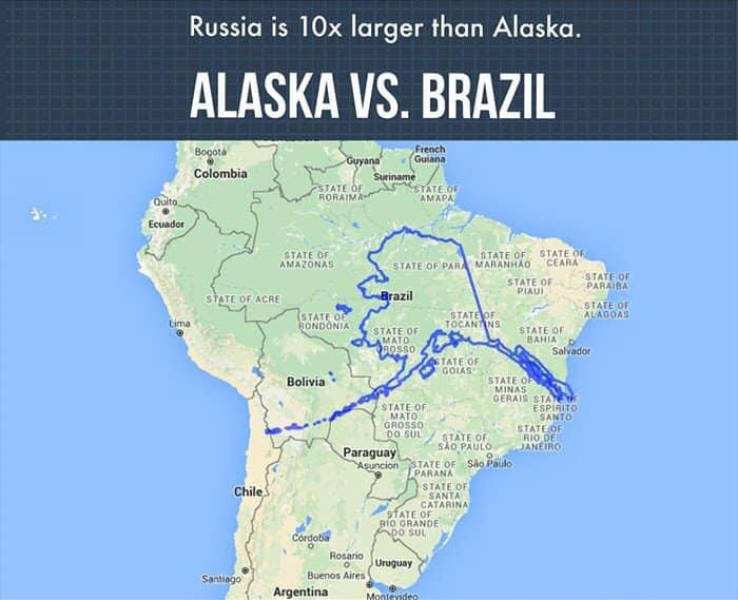
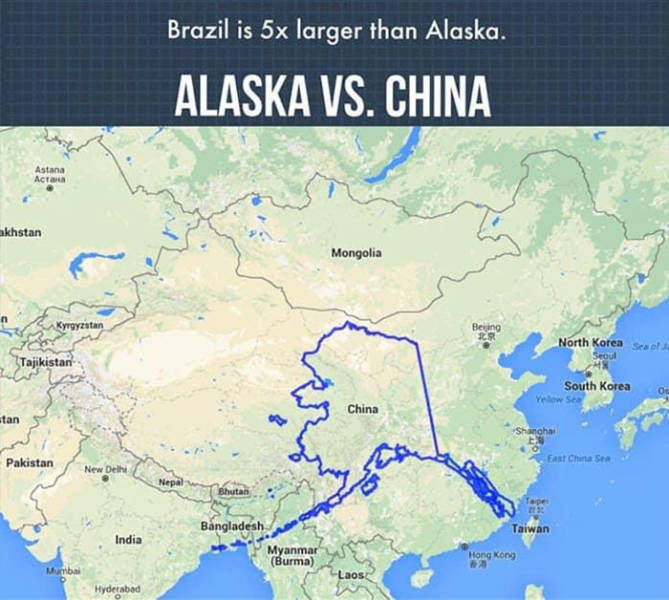
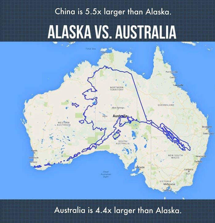
“I know most world maps used are inaccurate in size, the poles and upper hemispheres are all stretched and enlarged,” Ristay told. “Because of this, most people know Alaska is not how it’s depicted as being twice the size of the United States (Canada, Russia, Greenland all extremely enlarged as well).”
The artist also pointed out the other map offered in classrooms which has just the United States with Hawaii and Alaska off to the lower left side, in boxes. “People have honestly thought we were an island because they are so used to seeing that map.” To get a better understanding of the world’s proportions, Ristay suggests visiting TheTrueSize.com. “Honestly, it’s the most killer site and will blow your mind at the true sizes of locations.”
“I’m not sure why, beyond geography, Alaska is not talked about,” Ristay said. She has even heard some tourists asking if Alaskans use ‘American money’ and other weird questions like, “Are they actually citizens?”, “Can they vote?” and so on.
“Then there are some who can’t believe this is true and think these stories are exaggerated. But if you ask an Alaskan for any WTF tourist stories like this, we all have a handful,” Ristay added.
Ristay describes the response she has received online as ,”Holy sh*t, I did not know about this”. There were, however, a few commenters who still tried to debate the size of Alaska as being wrong in her depictions, and only when she made them use that mapping site did they fully get her point.
