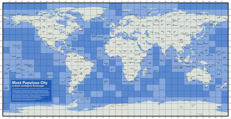
The largest city in each 10-by-10 degree area of latitude-longitude in the world
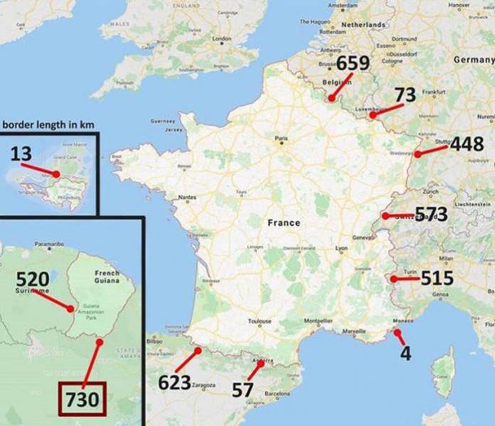
Frances longest border is shared with Brazil!
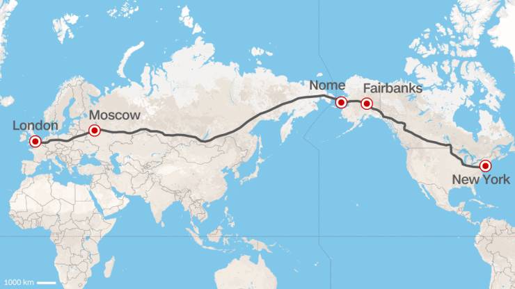
A Europe–U.S. superhighway proposed by the former president of Russian Railways
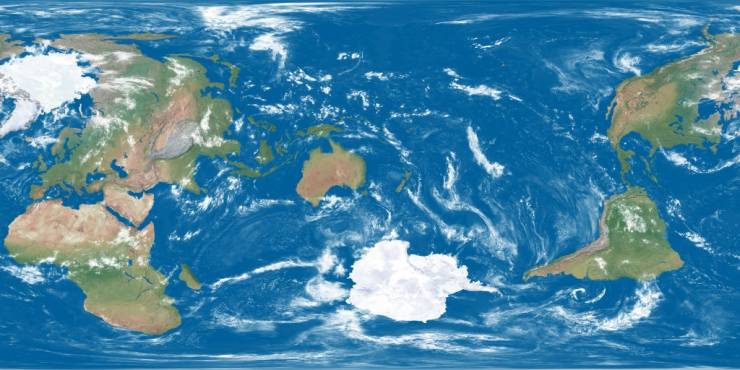
The earth being centered on Great Britain is arbitrary, so here's a map centered on New Zealand
220 world metro systems
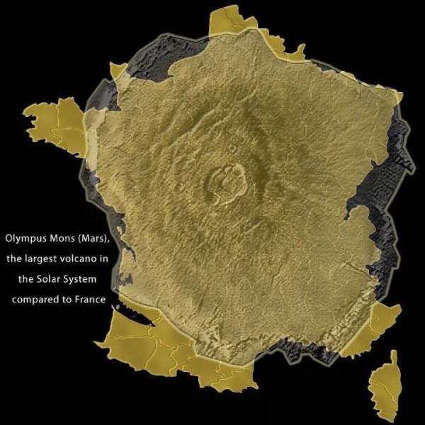
Olympus Mons compared to France
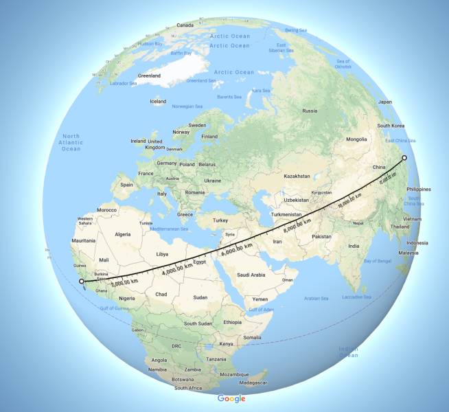
There is a straight line between Liberia and China with more that 13500 km without crossing any ocean or major body of water
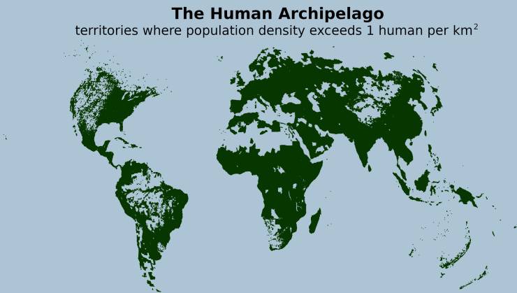
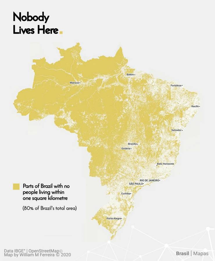
The Human Archipelago: territories where population density exceeds 1 human per km2
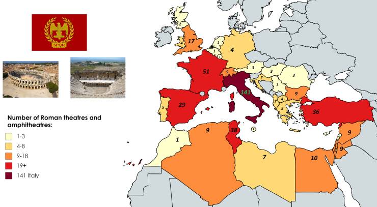
Number of Roman Theatres and Amphitheatres per country.
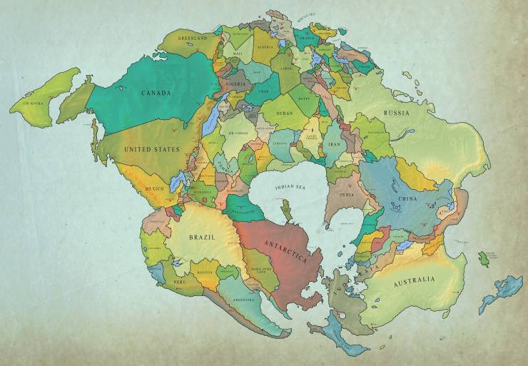
How earth will look with current international borders in 250 million years
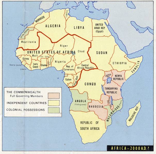
A 1963 prediction of Africa at the beginning of the 21st century
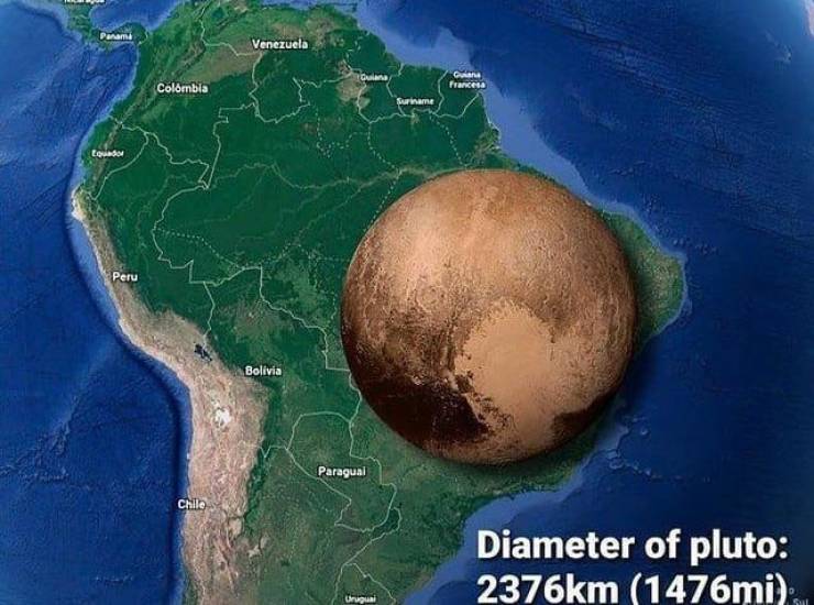
Pluto compared to South America
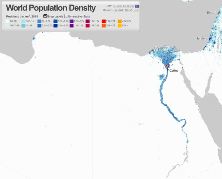
Population density map of Egypt.
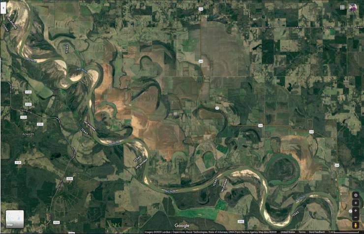
You can see all the different routes this river has taken over the years.
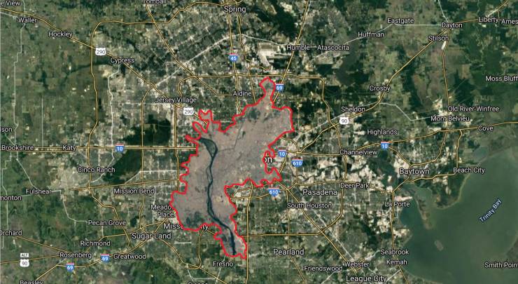
Size of Houston compared to Cairo, a city with 3 times the population
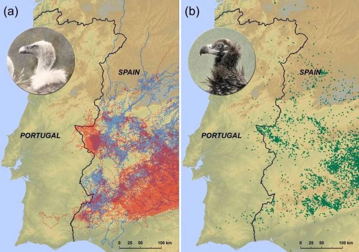
Tracked vultures recognise natural boundaries due to national differences in livestock carcass disposal
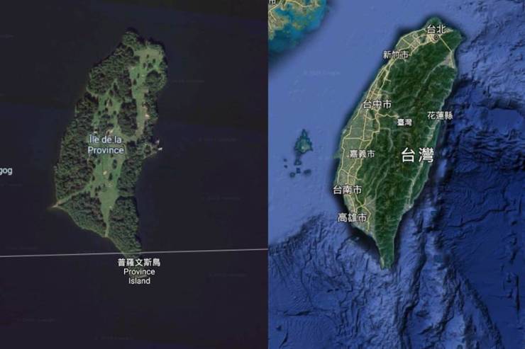
Taiwan's doppleganger spotted in Canada!
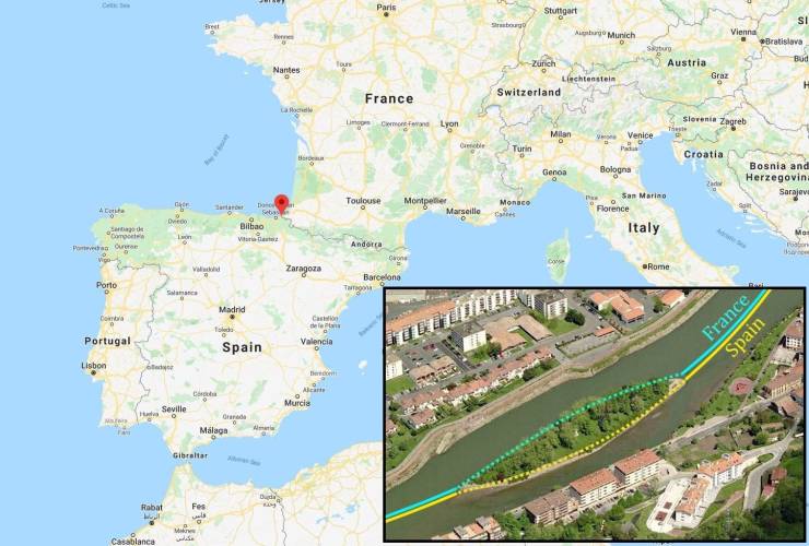
Pheasant island, the island that switches sovereignty between France and Spain every 6 months
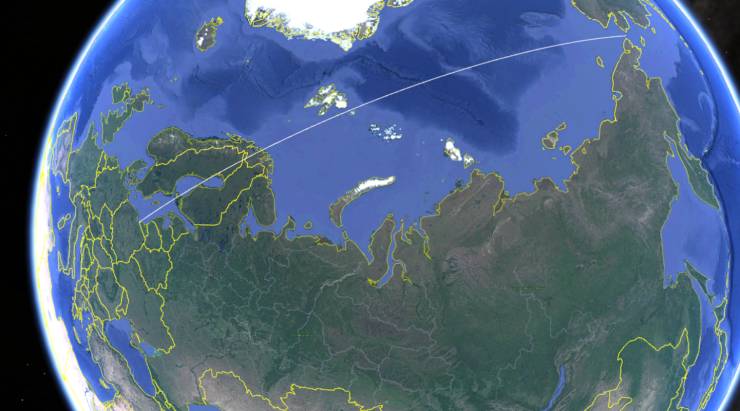
A Straight line between the Westernmost and Easternmost points of Russia passes through no Russian soil whatsoever.
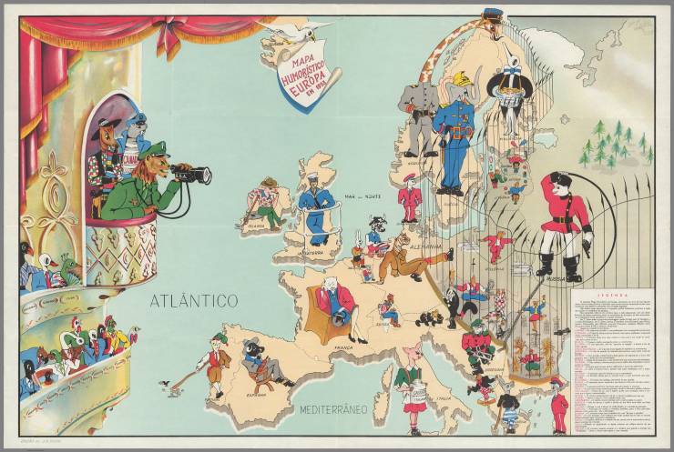
Portuguese satirical map of Europe from 1953
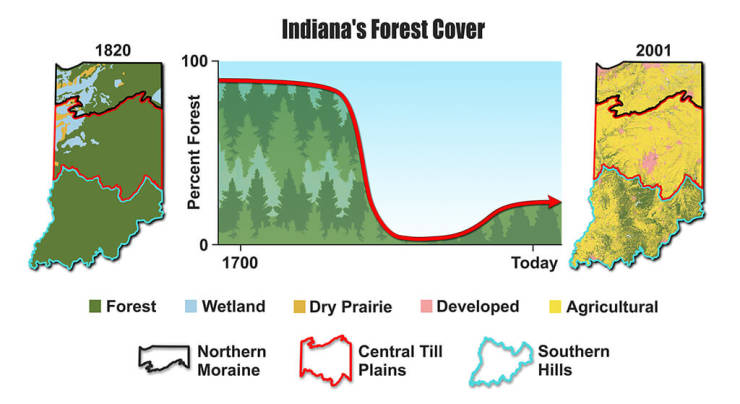
The Deforestation of Indiana
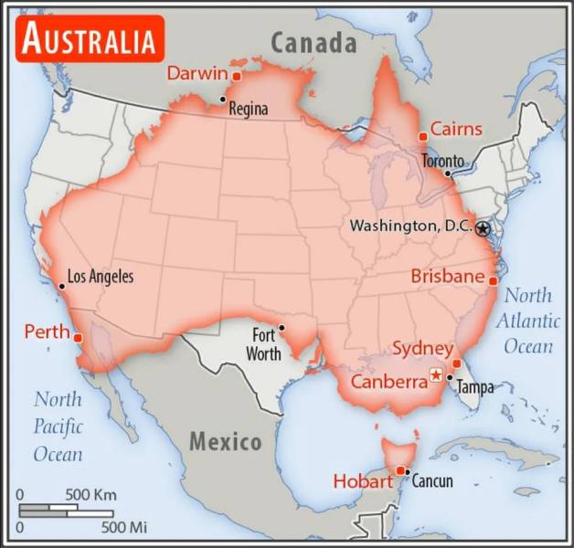
Australia to the United States
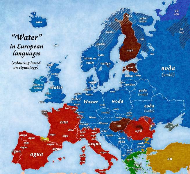
"Water" in European languages
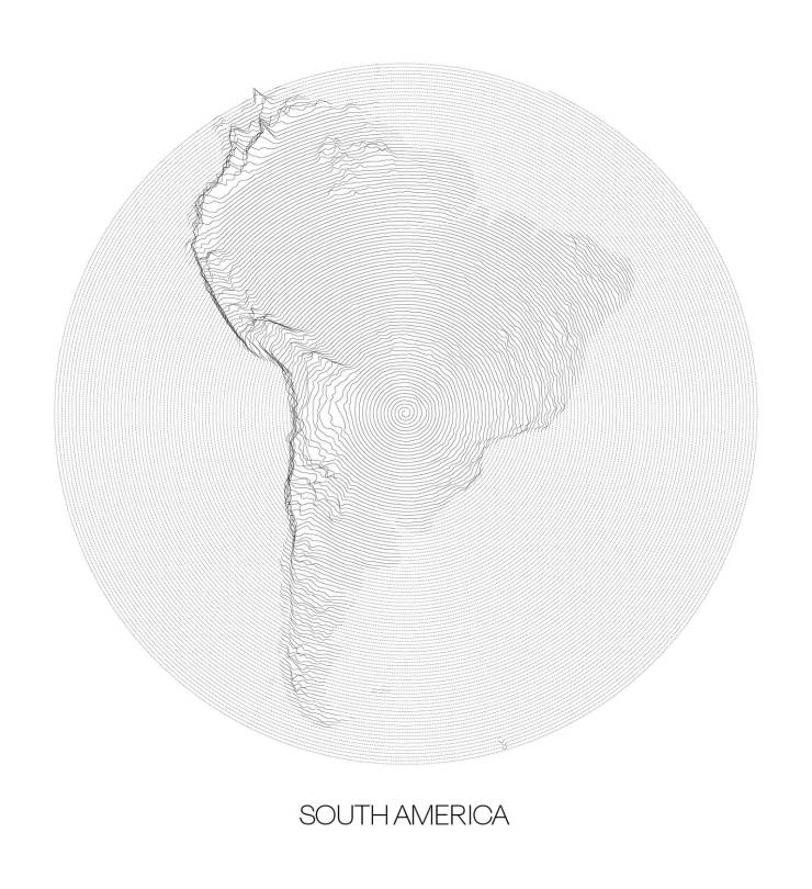
Topographic map of South America from a single spiral line
A Small World: What if America never existed
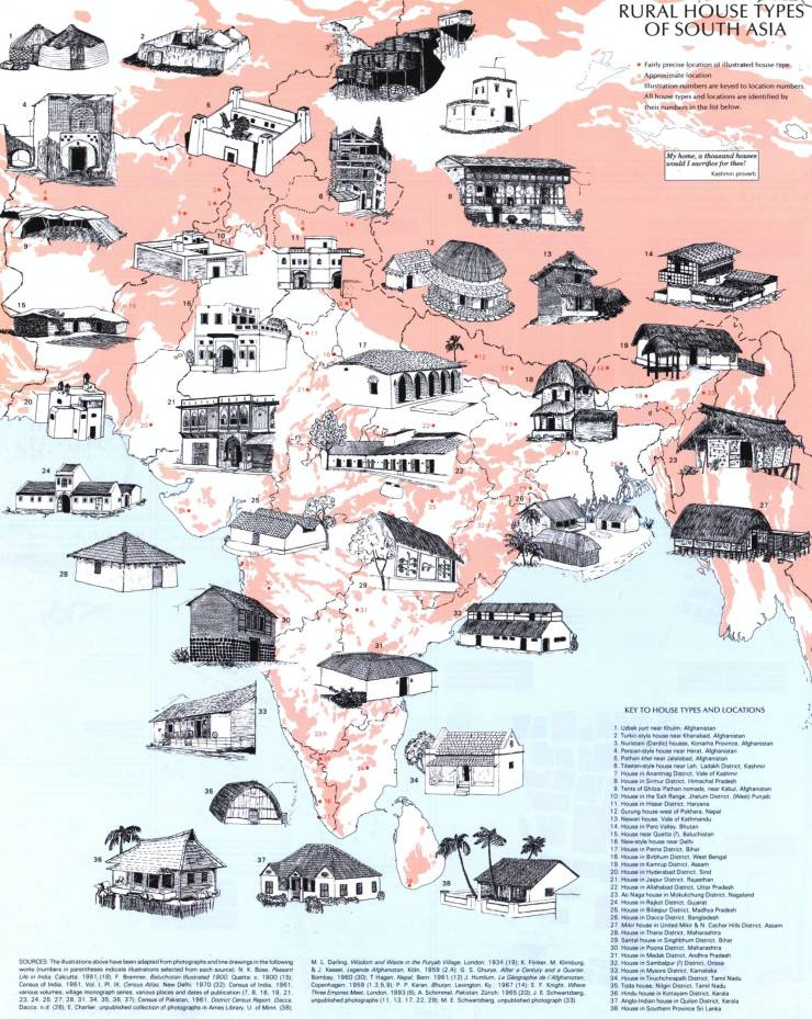
Rural House types of South Asia
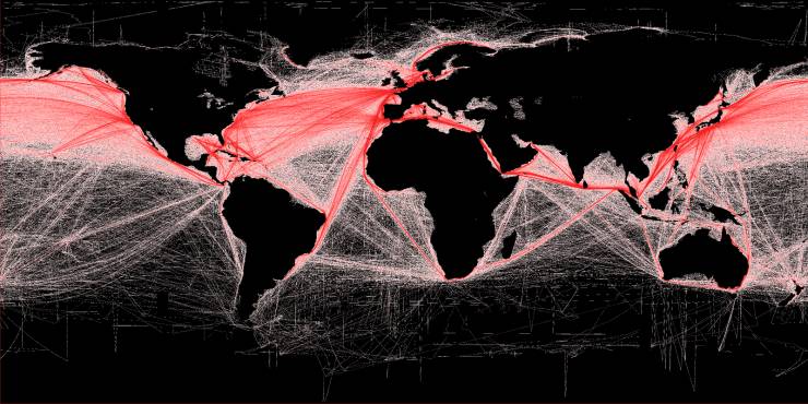
Map of shipping routes illustrates the relative density of commercial shipping in the world's oceans. By B.S. Halpern (T. Hengl; D. Groll)
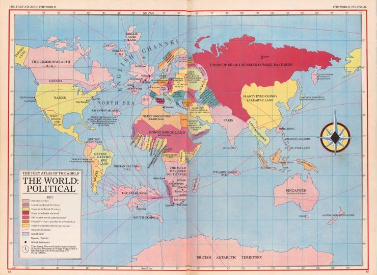
(1985) The Tory Atlas of the World
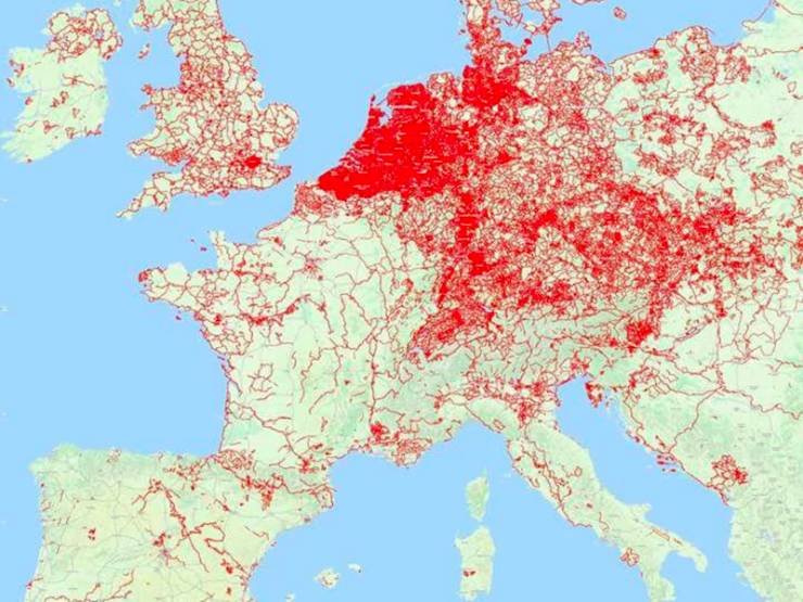
Bike Paths of Europe
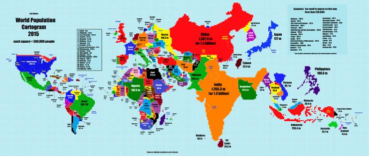
2015 world population cartogram
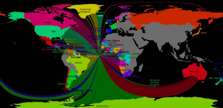
There's a spot in the Atlantic from which there are 60 different countries that can be sailed to in a straight line:




It is. Parts of turkey are on the european continent. There are turkish minorities in several other countries. You cannot ignore facts just because you don't like them like trump