Cool Maps Of United States Of America! (18 PICS)

Posted in PICTURES       2 Dec 2020       5249       2 GALLERY VIEW

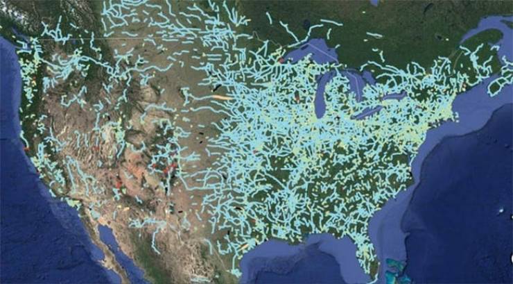
Out Of Service Railways

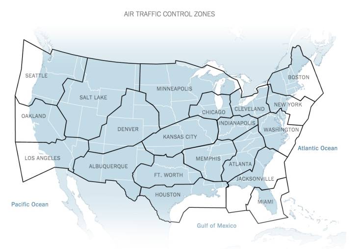
Broken Up By Air Traffic Control Zones

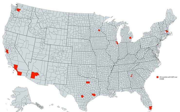
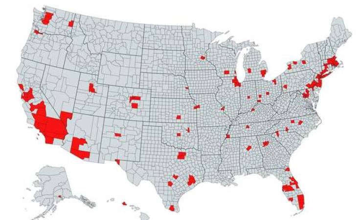
Counties With A GDP Over $100 Billion

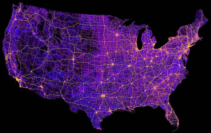
8 Million Miles Of Highways And Roads

Izismile Videos

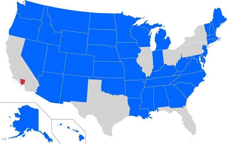
Blue States Have A Smaller Population Than Los Angeles County

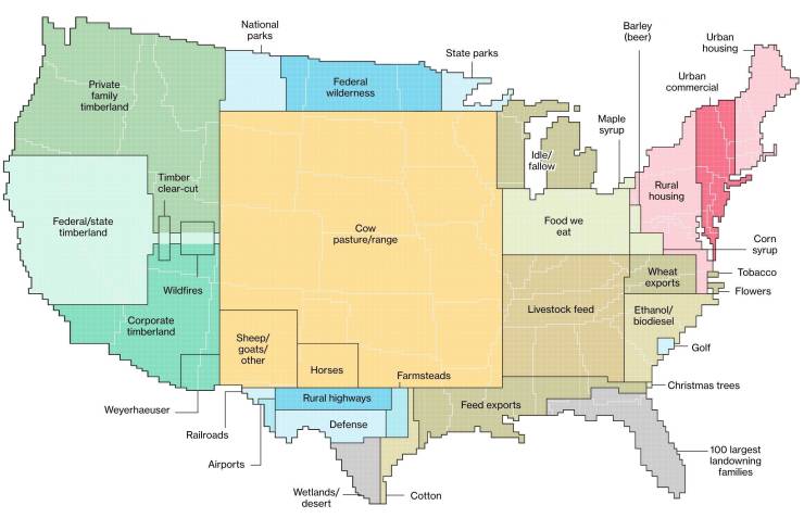
How We Use Land In The United States. 0% Is Zipline Territory And That’s Some BS

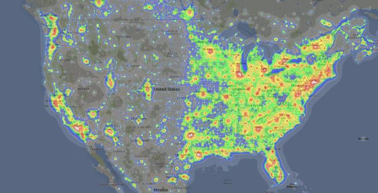
Light Pollution From Coast To Coast

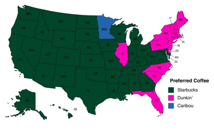
Popular Coffee Shop Chains By Number Of Locations

Advertisement

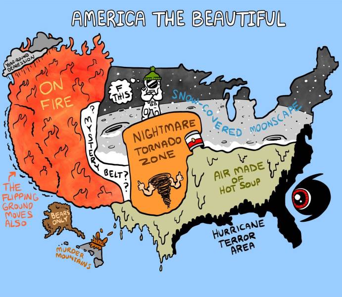
Dominant Regional Weather Types

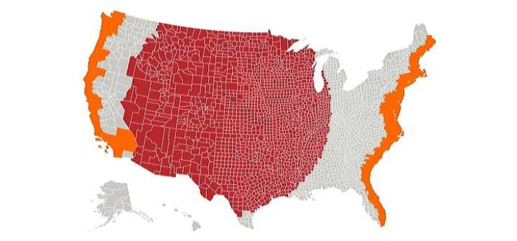
The Red And Orange Sections Have Equal Populations

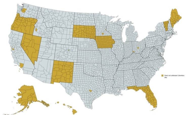
Regions That Do Not Officially Celebrate Columbus Day

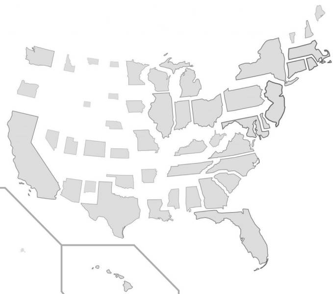
States Resized According To Population Density

Advertisement

The Red Area Features A Total Population Greater Than The Grey

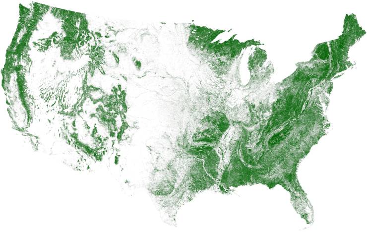
Tree Cover, Visualized

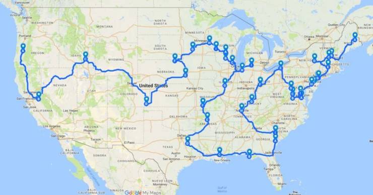
The Most Efficient Road Trip Through Every Springfield In The Country

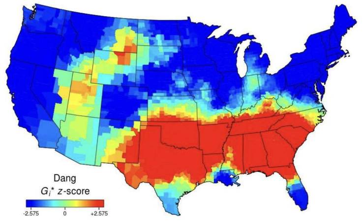
Use Of The Word “Dang” Across The Continental US

Advertisement

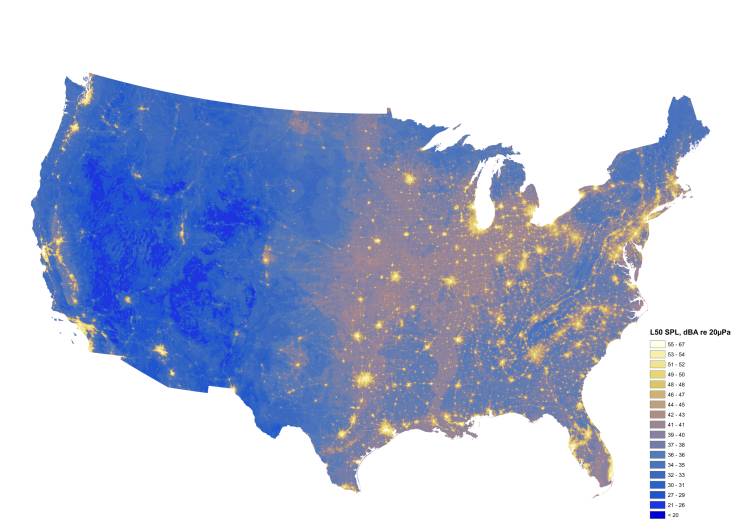
The Loudest And Quietest Spots In The Continental US

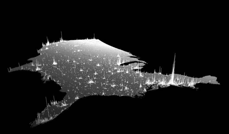
Population Spikes From A New Angle


Advertisement


Credits:  www.reddit.com


2   Comments ?
2
1.
Joey 4 year s ago
mr47_04
       
0
2.
salamoon 4 year s ago
i like #9 who is the author?
       
27353641acute
belayclappingdance3dashdirol
drinksfoolgirl_craygirl_devilgirl_witch
goodgreenheartJC-LOLJC_doubledown
JC_OMG_signkisslaughingman_in_lmocking
mr47_04musicokroflsarcastic
sm_80tonguevishenka_33vomitwassat
yahooshoot
/*secupdate
Advertisement


Advertisement


Advertisement

Archives

2023
2022
2021
2020
2019
2018
2017
2016
2015
2014
2013
2012
2011
2010
2009
2008
0000
Advertisement


How to comment

•    Don't insult other visitors. Offensive comments will be deleted without warning.

•    Comments are accepted in English only.

•    No swearing words in comments, otherwise such comments will be censored.

•    Your nickname and avatar are randomly selected. If you don't post comments for 7 days, they both are reset.

•    To choose another avatar, click the ‘Random avatar’ link.

random_banner_1