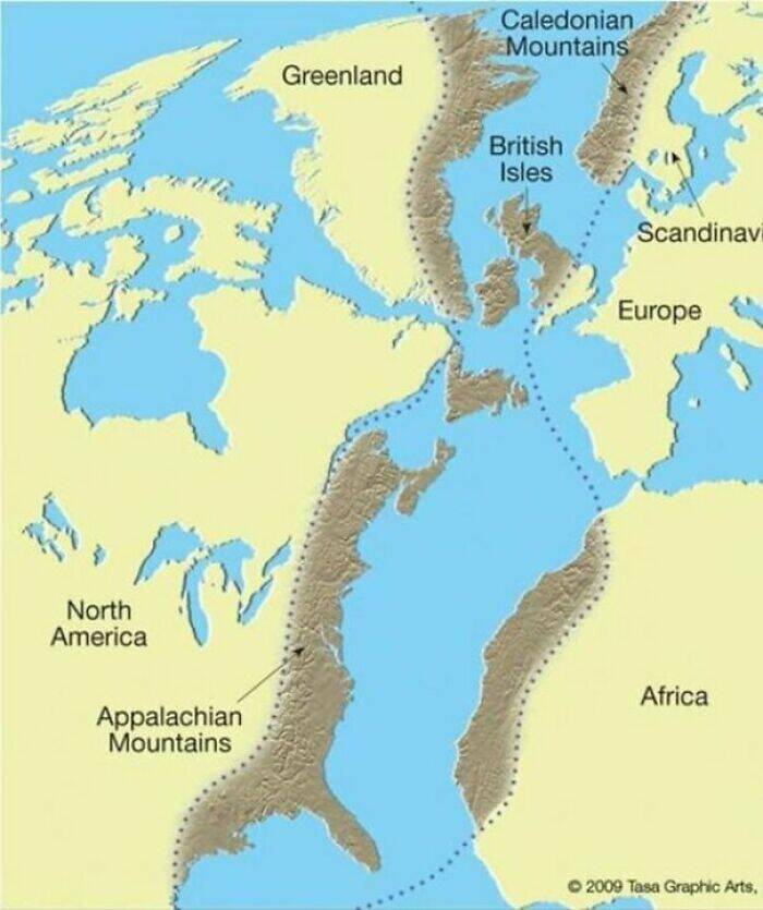
"The Scottish Highlands, The Appalachians, And The Atlas Are The Same Mountain Range, Once Connected As The Central Pangean Mountains"
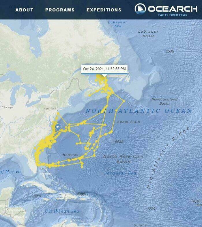
"Shark With Gps Paints A Shark On The Map"
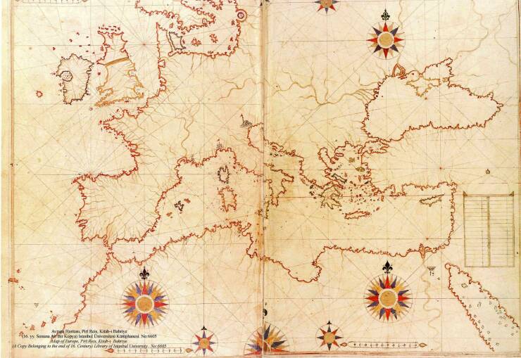
"This Map Was Drawn By Turkish Sailor/Cartographer Piri Reis In 1513"
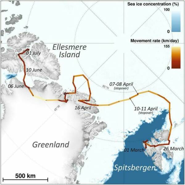
"The Incredible Journey Of An Arctic Fox Who Walked From Norway To Canada In 2018"
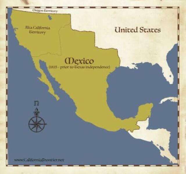
"Imagine What Would Happen If Some Mexican President Wanted To Restore The Country's Original Borders, Before The American Invasion"
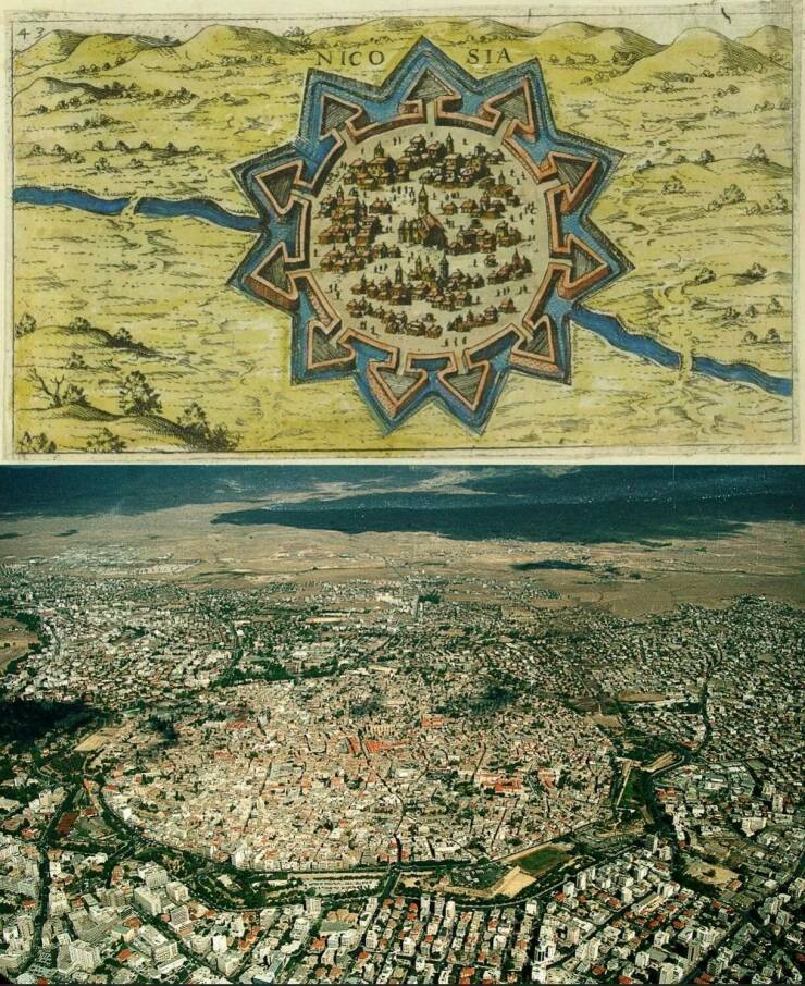
"A 16th Century Map Of Nicosia, Cyprus And The City From Above Today"
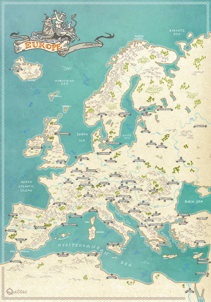
"My European Hand Drawn Line Art Fantasy Style Map"
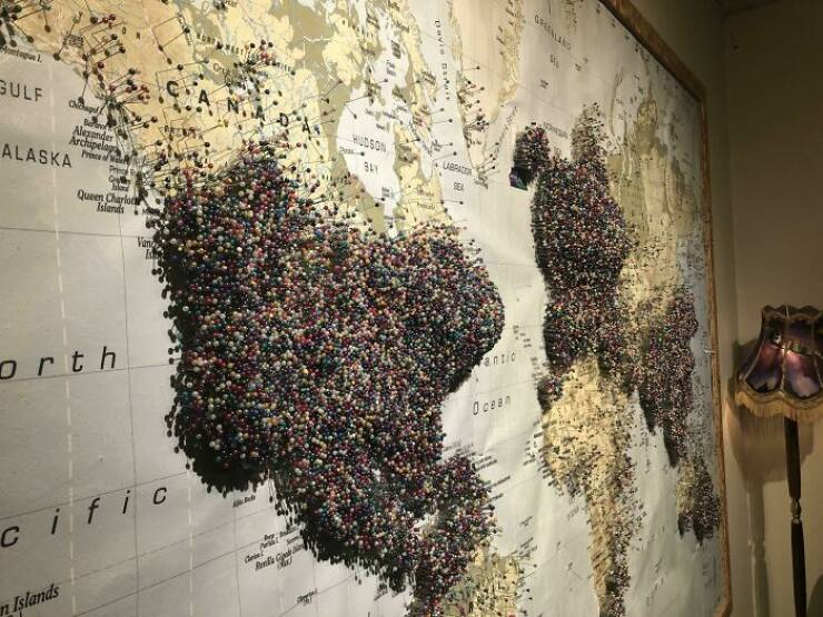
"This “Where Are You From” Map At The Aurora Museum In Reykjavík Iceland"
"Japanese Stereotypes Of Europe"
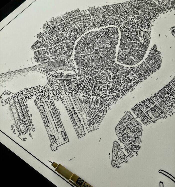
"Hand Drawn Map Of Venice Italy Nearly Completed"
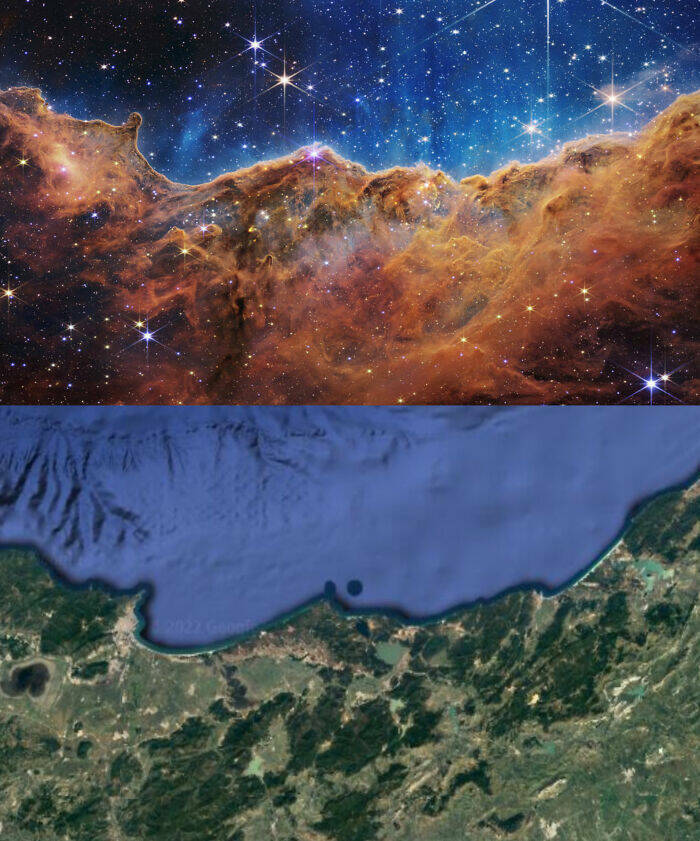
"Trending Now In Algeria : Image Of The Carina Nebula From James Webb Space Telescope Matching The Eastern Coast Of Algeria"
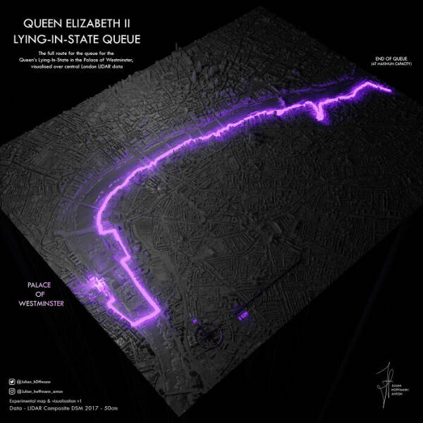
"Queue For Queen Elizabeth II - Visualisation"
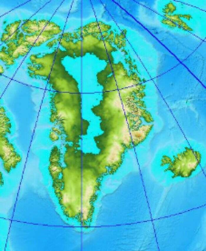
"Greenland Without Ice Would Reveal An Enormous Lake Right In The Center Of The Landmass"
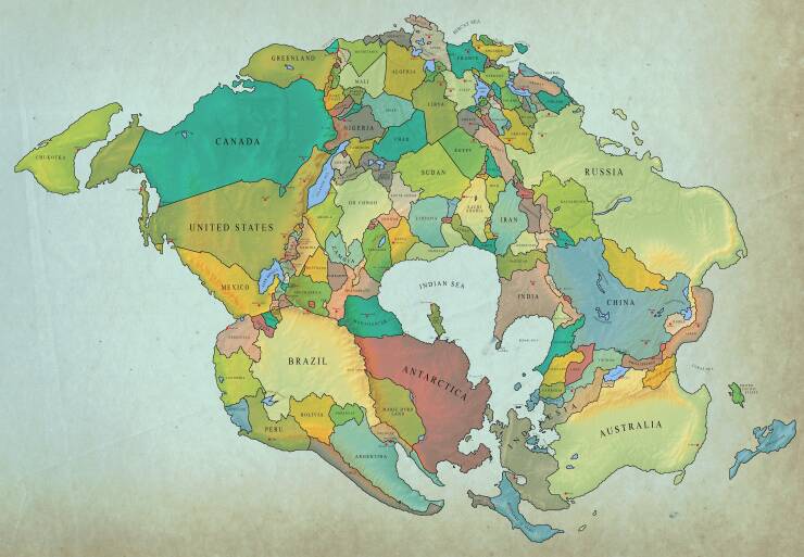
"How Earth Will Look With Current International Borders In 250 Million Years"
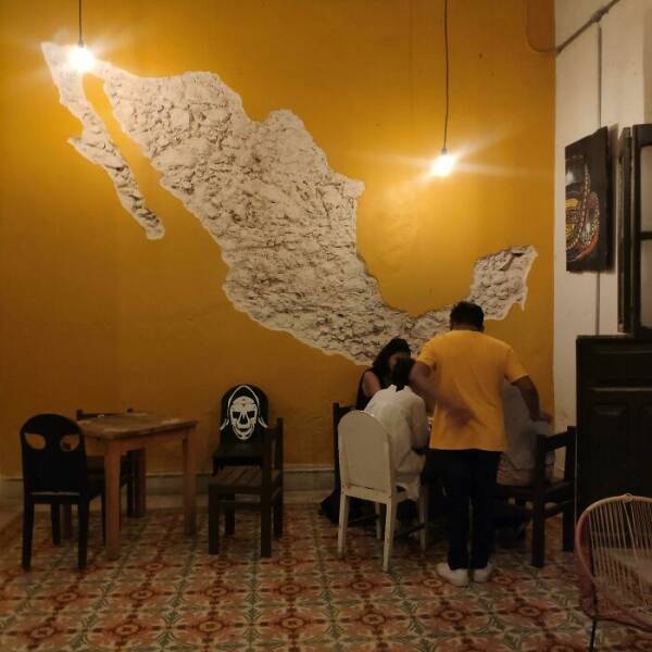
"A Map Of Mexico Carved On The Wall Of A Yucatan Bar"
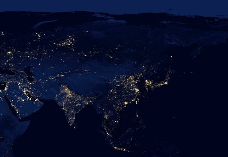
"The Continent Of Asia At Night"
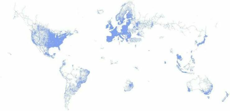
"The World According To Google Street View"




meh it's just some dumb hypothetical. look how trash mexico already is. you would set back tech advances by decades. Or look further back when the French owned most of the continent.
American invasion? America didn't exist. It was primarily the English, French, and Spanish that "invaded" North America. No one ever stops to think about why Mexicans speak SPANISH.
"Portugal - Weak"
Ouch
Ask the polish though...
Use a spherical globe, not a plane map.