Since 1972, Landsat satellites have collected images of the Earth’s land surface. These amazing pictures now reveal a visual story of how the land has changed over time as a result of natural and human interference. Each image spans a ground track of 115 miles (185 km’s) wide and the same area is recorded every 16 to 18 days.
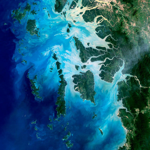
Mergui Archipelago, Myanmar
The Mergui Archipelago in the Andaman Sea consists of more than 800 islands. This natural-color image of the center portion of the archipelago was captured by Landsat 5 on Dec. 14, 2004.
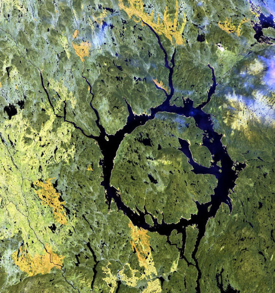
Manicouagan Impact Structure Quebec, Canada
This scene shows a glimpse of the Manicouagan Impact Structure in Quebec, Canada. Lake Manicouagan and Lake Mushalagan surround the central uplift of the crater. The original diameter of the crater was 62 miles (100 kilometers), and the age has been dated at 214 million years. Shattercones (striated features found in rocks deformed by the passage of shock waves), along with shattered and brecciated rocks found in the central uplift, confirm the crater’s impact origin. Several glacial advances have scoured the crater to its present form. It has been proposed that the impact was created by an asteroid with a diameter of about 3.1 miles (5 kilometers). June 1, 2001
Detroit, Michigan, USA
Detroit, Michigan, is commonly referred to as Motor City because of the many automobile manufacturing plants located in the city. It is the largest city in Michigan, with a population approaching one million. December 11, 2001
Belcher Islands, Canada
Like sweeping brushstrokes of pink and green, the Belcher Islands meander across the deep blue of Canada’s Hudson Bay. The islands’ only inhabitants live in the small town of Sanikiluaq, near the upper end of the middle island. Despite the green hues in this image, these rocky islands are too cold to sustain more than a smattering of low-growing vegetation. September 21, 2001
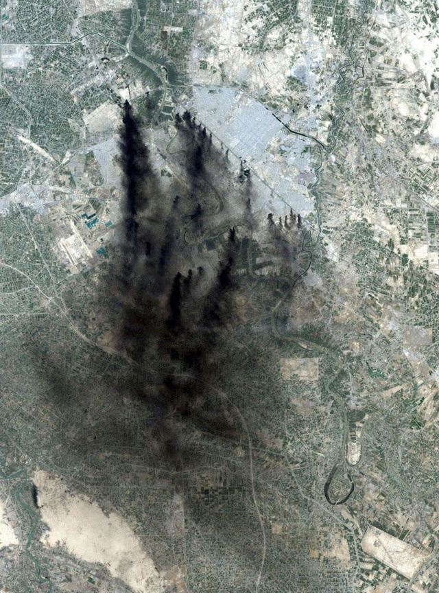
Baghdad, Iraq April 2003
Fires from coalition bombing during the second war in Iraq provided a dramatic, smoke-filled image over Baghdad. The Tigris River snakes north to south in this image. Baghdad International Airport is west of the smoke. April 2, 2003
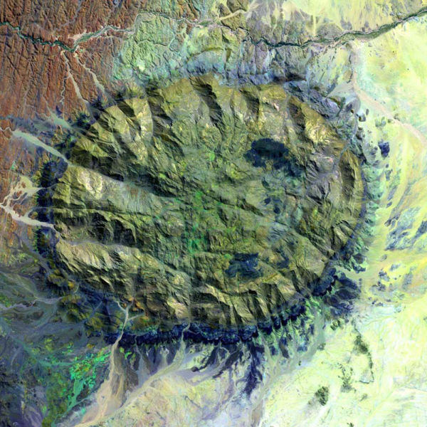
Brandberg Massif, Namibia
Brandberg Massif is a dome-shaped granite intrusion that covers 250 square miles (650 square kilometers) and rises 1.6 miles (2,573 meters) above its surroundings in the central Namib Desert. Brandberg Massif is an important habitat for high-altitude savannah species and is of great archaeological interest due to the many prehistoric cave paintings found among its granite cliffs. September 10, 2002
Growth in the Desert – Las Vegas
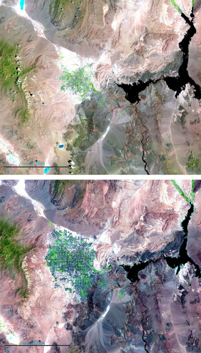
These images from 1984 and 2007 show the increasing urban sprawl of Las Vegas, Nevada, and the shrinking of Lake Mead on the border of Nevada and Arizona. Rapid growth in Las Vegas has led to increased demand for water resources, while below-average rainfall has decreased the water levels in Lake Mead, which is the source of 90 percent of southern Nevada’s water. 1984/2007
Mt. Fuji and Fuji Five Lakes area, Japan
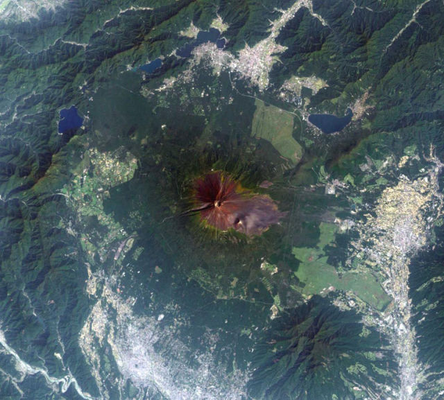
The Fuji Five Lakes area, with Mt. Fuji as the centerpiece, is one of Japan’s most popular tourist destinations. Mt. Fuji, as Japan’s highest peak at 12,388 feet (3,776 meters), is a dormant volcano that last erupted in 1707. October 4, 2002
Aral Sea
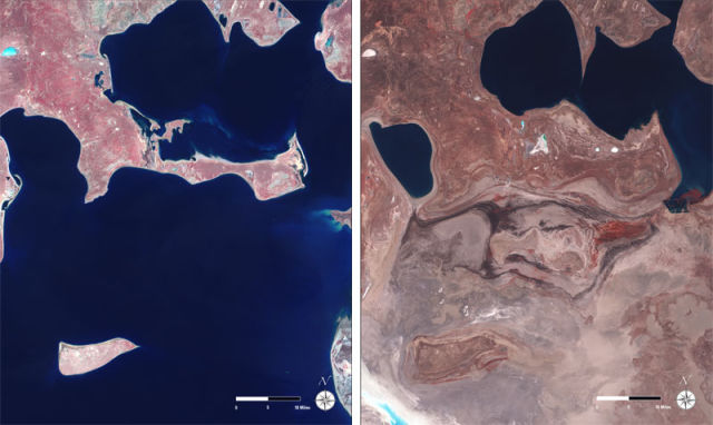
The Aral Sea, once the 4th largest lake in the world, continues to shrink and is now 10% of its original size. U.N. Secretary General Ban Ki-moon recently called the drying up of the Aral Sea on of the planet’s most shocking disasters. Feeder streams to the sea have been diverted by irrigation and by the completion of upstream dam projects. The result has been the ruin of the local fishing and shipping economy, and wind-carried salty sands have created regional health problems. May 29, 1973/October 18, 2009
Houston, Texas, USA
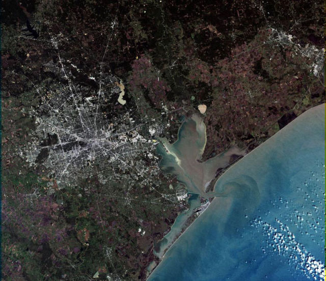
Houston, situated on the Gulf of Mexico and home to 2.14 million people, is the nation’s fourth largest city and a hub of international business. The Houston Ship Canal connects the Port of Houston to the Gulf of Mexico through Galveston Bay. December 22, 2000
Wabash and Ohio Rivers
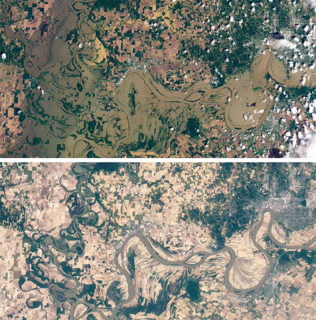
These two images show the Wabash and Ohio Rivers near Evansville, Indiana, while flooded (May 3, 2011, top image) and after the waters had receded (June 4, 2011, bottom image). Landsat 5 took these natural-color images with its Thematic Mapper. May 3, 2011/June 4, 2011
Philadelphia, Pennsylvania, USA
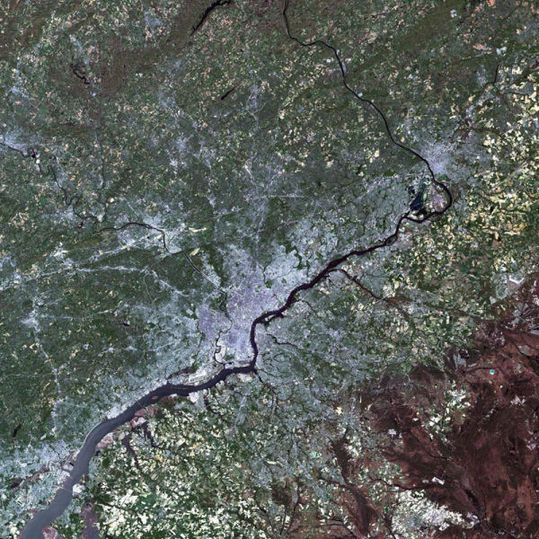
Philadelphia is the sixth largest city in the United States. Much of America’s early history took place in Philadelphia, including the signing of the Declaration of Independence. Serving a short term as the Nation’s Capitol (1790 -1800), the town was the home of Washington and Adams during their presidency. April 24, 2002
Lake Powell, Utah, USA
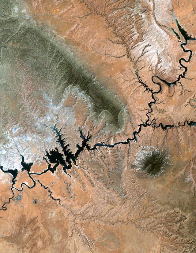
Lake Powell stretches hundreds of miles from Lees Ferry in Arizona to the Orange Cliffs of southern Utah. At more than 400 feet (122 meters) deep, 150 miles (241 kilometers) long, and with nearly 2,000 miles (3,219 kilometers) of shoreline, Lake Powell is the nation’s second largest man-made lake, second only to Lake Mead in Nevada. In 2004, it was at its lowest water level in over 30 years due to the ongoing drought in the western United States. June 1, 2004
Nazca Lines, Peru
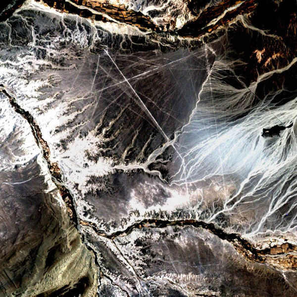
In the desert of southwest Peru, between the Andes Mountains and the Peruvian coast, lies a plateau with huge geometric patterns and spirals, animal figures including a monkey, a spider, and an ‘owl man,’ and thousands of perfectly straight lines. The last of these was drawn about a thousand years ago. Known as the Nazca lines, the drawings have mystified scientists since they were first discovered in the 1920s. Pictured here is all that can be seen of these lines by Landsat 7′s 15 meter pan band, which has been used to sharpen the 30 meter Bands 3, 2, and 1. November 10, 2002
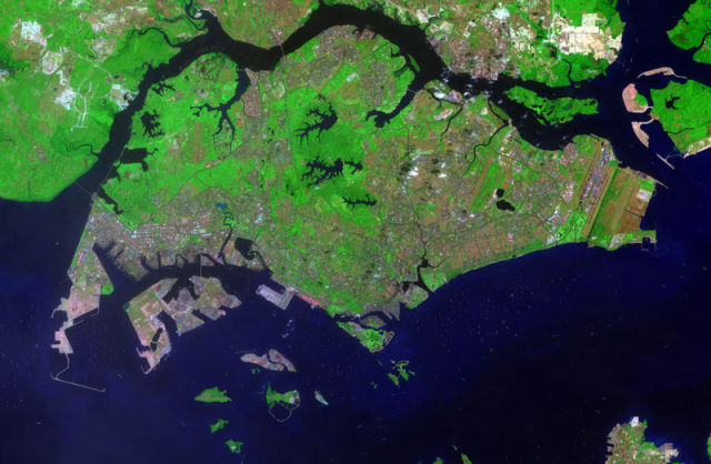
Singapore
Just over 3.5 times the size of Washington, D.C., Singapore’s population is 100% urban (over 4.7 million people). This image was created with bands 7,4,2 to minimize the atmospheric effects of haze and humidity. February 8, 2009

